Kaza, Himachal Pradesh
|
Kaza, Himachal Pradesh Kaza Karze or Karzey |
|
|---|---|
| town | |
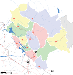
| Location in Himachal Pradesh, India | |
| Coordinates: 32°13′N 78°05′E / 32.22°N 78.08°ECoordinates: 32°13′N 78°05′E / 32.22°N 78.08°E | |
| Country |
|
| State | Himachal Pradesh |
| District | Lahaul and Spiti |
| Elevation | 3,800 m (12,500 ft) |
| Population | |
| • Total | 3,231 |
| Languages | |
| • Official | Hindi |
| Time zone | IST (UTC+5:30) |
| PIN | 172114 |
| Telephone code | 01906 - STD code |
| Vehicle registration | H.P.- 42 |
| Sex ratio | 974 ♂/♀ |
The town of Kaza, Kaze or Kaja is the subdivisional headquarters of the remote Spiti Valley in the Lahaul and Spiti district of the state of Himachal Pradesh in the Western Himalayas of India. Spiti, which is a part of the Lahaul and Spiti district of Himachal, is a high altitude or cold desert having close similarities to the neighbouring Tibet and Ladakh regions in terms of terrain, climate and the Buddhist culture. Kaza, situated along the Spiti River at an elevation of 3,650 metres (11,980 ft) above mean sea level, is the largest township and commercial center of the valley .
The town is divided into the old, as Kaza Khas and new as Kaza Soma sections. The new town contains the administrative buildings. The Tangyud (Tang-rGyud) Gompa dates to the early 14th century and is built like a fortified castle with massive slanted mud walls and battlements with vertical red ochre and white vertical stripes. It is on the edge of a deep canyon and overlooking the town of Kaza, 4 km from the town. Approaching it from the south one sees Kyu-ling (Skyid-gling), the stately palace of the Nono (king) on the other side of the river.
Kaza is overlooked by high mountain ridges on all sides. It has two access points : one from Kinnaur valley and the other from the Lahaul valley, 11 km from Ki Monastery, the famous Gelugpa establishment. The route through Kinnaur is open throughout the year, except for occasional short periods resulting from landslides or heavy snowfall. This road, starting from Shimla, follows the Sutlej river unto a little beyond Poo, thereafter turning northwards to follow the Spiti river all the way to Kaza. The other road starts from Manali and after crossing the 13,090-foot (3,990 m) high Rohtang Pass to reach Gramphoo where it joins the road from Keylong and proceeds south along Chandra River till Batal then climbs up to cross the 14,928-foot (4,550 m) high Kunzum pass, enters the Spiti valley to reach Kaza. It remains closed during winter months, normally from October end to June due to heavy snowfall on both the passes.Kaza is the one of the coldest towns in India. The temperature varies greatly in a different seasons and during a day, January is the coldest period of a year with an average temperature of -45 °C,while the July is hottest month with an average temperature of 10 °C.
...
Wikipedia


