Kauai County, Hawaii
| Kauai County, Hawaii | ||
|---|---|---|
|
||
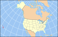
 Location in the U.S. state of Hawaii |
||
 Hawaii's location in the U.S. |
||
| Founded | 1905 | |
| Seat | Lihue | |
| Largest community | Kapa‘a | |
| Area | ||
| • Total | 1,266 sq mi (3,279 km2) | |
| • Land | 620 sq mi (1,606 km2) | |
| • Water | 646 sq mi (1,673 km2), 51.0% | |
| Population (est.) | ||
| • (2015) | 71,735 | |
| • Density | 108/sq mi (42/km²) | |
| Congressional district | 2nd | |
| Time zone | Hawaii-Aleutian: UTC-10 | |
| Website | www |
|
Kauaʻi County is a county located in the U.S. state of Hawaiʻi. It consists of the islands of Kauaʻi, Niʻihau, Lehua, and Kaʻula. As of the 2010 Census the population was 67,091. The county seat is Līhuʻe.
The Kapa'a Micropolitan Statistical Area includes all of Kauai County.
According to the U.S. Census Bureau, the county has a total area of 1,266 square miles (3,280 km2), of which 620 square miles (1,600 km2) is land and 646 square miles (1,670 km2) (51.0%) is water. The Pacific Ocean surrounds the county.
Kauaʻi County has a mayor-council form of municipal government. Executive authority is vested in the Mayor of Kauaʻi, elected by the voters on a non-partisan basis to a four-year term. Legislative authority is vested in the seven-member County Council. All members of the County Council are elected on a non-partisan, at-large basis to two-year terms.
As of the census of 2000, there were 58,463 people, 20,183 households, and 14,572 families residing in the county. The population density was 94 people per square mile (36/km²). There were 25,331 housing units at an average density of 41 per square mile (16/km²). The racial makeup of the county was 29.5% White, 0.3% Black or African American, 0.4% Native American, 36.0% Asian, 9.1% Pacific Islander, 0.9% from other races, and 23.8% from two or more races. 8.2% of the population were Hispanic or Latino of any race.
...
Wikipedia

