Katy, Texas
| Katy, Texas | |
|---|---|
| City | |
 |
|
| Motto: "Small Town Charm with Big City Convenience" | |
 Location in the state of Texas and Harris County |
|
| Coordinates: 29°47′33″N 95°49′21″W / 29.79250°N 95.82250°WCoordinates: 29°47′33″N 95°49′21″W / 29.79250°N 95.82250°W | |
| Country | United States |
| State | Texas |
| Counties | Harris, Fort Bend, Waller |
| Incorporated | 1945 |
| Government | |
| • Mayor | Fabol Hughes |
| Area | |
| • Total | 11.30 sq mi (29.26 km2) |
| • Land | 11.25 sq mi (29.15 km2) |
| • Water | 0.0 sq mi (0.11 km2) |
| Elevation | 141 ft (43 m) |
| Population (2010) | |
| • Total | 14,102 |
| • Estimate (2015) | 16,158 |
| • Density | 1,436/sq mi (554.3/km2) |
| Demonym(s) | Katyite |
| Time zone | CST (UTC-6) |
| • Summer (DST) | CDT (UTC-5) |
| ZIP codes | 77400-77499 |
| Area code(s) | 281 |
| FIPS code | 48-38476 |
| GNIS feature ID | 1338960 |
| Website | cityofkaty |
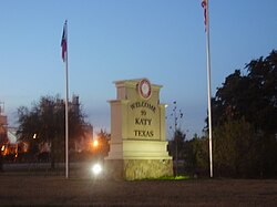
Katy is a city in the U.S. state of Texas, within the Houston–The Woodlands–Sugar Land metropolitan area. The city is located in Harris, Fort Bend, and Waller counties. The population was 14,102 at the 2010 census, up from 11,775 at the 2000 census. The population was estimated to be 16,158 in 2015.
In the mid-1800s Katy was known as "Cane Island", named for the creek that runs through the area, a branch of Buffalo Bayou. The creek was filled with cane, presumed to have been planted by earlier residents to aid in fur trapping. In the middle of the flat coastal prairie, this "island" of cane was surrounded by an ocean of tall grass; thus the area became known as "Cane Island". The trail from Harrisburg to San Antonio, known as the San Felipe Road, ran right through it.
In 1845 James J. Crawford received a land grant that included this area. The hot summers, cold winters, thick mud and voracious mosquitoes made it difficult to attract settlers to the area. Thirty years later Crawford, John Sills, and freedmen Thomas and Mary Robinson were the only recorded residents of Cane Island. In 1893 the Missouri–Kansas–Texas Railroad (now a part of Union Pacific) started laying rails through Cane Island. The railroad began operation in 1895.
That same year James Oliver Thomas laid out a town, and in January 1896 the town of Katy was named through Thomas's post office application. The name was based on the MKT Railroad (which was called "the Katy" by railroad officials) and the anticipations of prosperity its arrival would bring to the new town. The town developed around the original train stop and railroad tracks.
By the early 1900s many families had come by train and wagon to establish Katy. Several hotels, stores, liveries and saloons were prospering, and farms and ranches were being developed on the wild prairie. Cotton and peanuts were the first successful crops, but rice soon became the primary commodity crop. Katy later became known for rice farming; the first concrete rice driers in the state of Texas were built here in 1944 and still stand as landmarks.
...
Wikipedia
