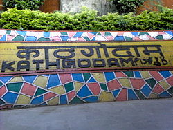
Kathgodam
|
Kathgodam काठगोदाम |
|
|---|---|
| town | |

Kathgodam Railway Station
|
|
| Location in Uttarakhand, India | |
| Coordinates: 29°16′05″N 79°32′42″E / 29.268°N 79.545°ECoordinates: 29°16′05″N 79°32′42″E / 29.268°N 79.545°E | |
| Country |
|
| State | Uttarakhand |
| District | Nainital |
| Elevation | 554 m (1,818 ft) |
| Population (2001) | |
| • Total | 129,140 |
| Languages | |
| • Official | Hindi, Urdu |
| Time zone | IST (UTC+5:30) |
| Vehicle registration | UK-01, UP-05(Auto), UP-06 (Car), UA-01 |
| Website | uk |
Kathgodam is a town in the Nainital district of Uttarakhand state of India. It is part of the twin township of Haldwani-Kathgodam, and is immediately north of Haldwani. It is one of the important collection centres for forest products obatained from Kumaon Himalayas.
Literally meaning timber depot, Kathgodam was a small village in 1901 with a population of 375, though its importance grew rapidly after the railway line was extended here in late 19th century, after it reached Haldwani in 1884. It was previously called 'Chauhan Patta' as it is still recorded in the land records. The advent of the residence of Dan Singh Bist nearby in Beer Bhatti, Jeolikote, and his setting up his major timber depot as the 'Timber King of India' as Chauhan Patta, led to it being called 'Kathgodam'. Similarly, Beer Bhatti is called thus as it was previously an area where the British India Corporation Limited pursued a Beer Brewery until 1924 when Dan Singh Bist purchased it from them via deed registered at Nainital.
Today, it is the last station on its Indian Railways line; from this point, one must travel by automobile to the Kumaon region of the Himalayan Mountains. From Kathgodam, mountain roads lead to tourist destinations like Nainital, Bhimtal, Sattal, Mukteshwar, Ranikhet, Binsar, Kausani, Naukuchiyatal and Almora.
Kathgodam is located at 29°16′N 79°32′E / 29.27°N 79.53°E. It has an average elevation of 554 metres (1,483 feet). It is situated on the banks of the Gaula river.
...
Wikipedia


