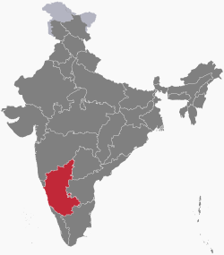
Karnatak
|
Karnataka ಕರ್ನಾಟಕ (ಬೆಂಗಳೂರು) |
||
|---|---|---|
| State | ||
|
||
 Map of Karnataka |
||
| Coordinates (Bangalore): 12°58′N 77°30′E / 12.97°N 77.50°ECoordinates: 12°58′N 77°30′E / 12.97°N 77.50°E | ||
| Country |
|
|
| Formation | 1 November 1956 (as Mysore State) |
|
| Capital City | Bangalore (Bengaluru) | |
| Largest city | Bangalore | |
| Districts | 30 | |
| Government | ||
| • Body | Government of Karnataka | |
| • Governor | Vajubhai Vala | |
| • Chief Minister | Siddaramaiah (INC) | |
| • Legislature | Bicameral (224 + 75 seats) | |
| • High Court | Karnataka High Court | |
| Area | ||
| • Total | 191,791 km2 (74,051 sq mi) | |
| Area rank | 7th | |
| Highest elevation | 1,925 m (6,316 ft) | |
| Lowest elevation | 0 m (0 ft) | |
| Population (2011) | ||
| • Total | 61,130,704 | |
| • Rank | 8th | |
| • Density | 320/km2 (830/sq mi) | |
| Demonym(s) | Kannadiga | |
| Time zone | IST (UTC+05:30) | |
| ISO 3166 code | IN-KA | |
| Official language | Kannada | |
| Regional Languages | Tulu,Kodava, Konkani,Beary | |
| Literacy Rate | 75.60% (16th in states, 23rd if Union Territories are counted) | |
| HDI |
|
|
| HDI rank | 8th (2015)) | |
| Website | karnataka.gov.in | |
| Symbols of Karnataka | ||
| Emblem | Gandaberunda | |
| Language | Kannada | |
| Song | Jaya Bharata Jananiya Tanujate | |
| Dance | Yakshagana | |
| Animal | Asian elephant | |
| Bird | Indian Roller | |
| Flower | Lotus | |
| Tree | Sandalwood | |
| Population Growth | |||
|---|---|---|---|
| Census | Pop. | %± | |
| 1951 | 19,402,000 |
—
|
|
| 1961 | 23,587,000 | 21.6% | |
| 1971 | 29,299,000 | 24.2% | |
| 1981 | 37,136,000 | 26.7% | |
| 1991 | 44,977,000 | 21.1% | |
| 2001 | 52,850,562 | 17.5% | |
| 2011 | 61,095,297 | 15.6% | |
| Source:Census of India | |||
Karnataka is a state in south western region of India. It was formed on 1 November 1956, with the passage of the States Reorganisation Act. Originally known as the State of Mysore, it was renamed Karnataka in 1973. The capital and largest city is Bangalore (Bengaluru). Karnataka is bordered by the Arabian Sea and the Laccadive Sea to the west, Goa to the northwest, Maharashtra to the north, Telangana to the northeast, Andhra Pradesh to the east, Tamil Nadu to the southeast, and Kerala to the southwest. The state covers an area of 191,976 square kilometres (74,122 sq mi), or 5.83 percent of the total geographical area of India. It is the seventh largest Indian state by area. With 61,130,704 inhabitants at the 2011 census, Karnataka is the eighth largest state by population, comprising 30 districts. Kannada, one of the classical languages of India, is the most widely spoken and official language of the state.
The two main river systems of the state are the Krishna and its tributaries, the Bhima, Ghataprabha, Vedavathi, Malaprabha, and Tungabhadra, in the north, and the Kaveri and its tributaries, the Hemavati, Shimsha, Arkavati, Lakshmana Thirtha and Kabini, in the south. Most of these rivers flow out of Karnataka eastward into the Bay of Bengal.
...
Wikipedia

