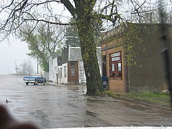
Karlsruhe, North Dakota
| Karlsruhe, North Dakota | |
|---|---|
| City | |

A view of Karlsruhe
|
|
 Location of Karlsruhe, North Dakota |
|
| Coordinates: 48°5′27″N 100°37′15″W / 48.09083°N 100.62083°WCoordinates: 48°5′27″N 100°37′15″W / 48.09083°N 100.62083°W | |
| Country | United States |
| State | North Dakota |
| County | McHenry |
| Area | |
| • Total | 0.75 sq mi (1.94 km2) |
| • Land | 0.75 sq mi (1.94 km2) |
| • Water | 0 sq mi (0 km2) |
| Elevation | 1,542 ft (470 m) |
| Population (2010) | |
| • Total | 82 |
| • Estimate (2014) | 87 |
| • Density | 109.3/sq mi (42.2/km2) |
| Time zone | Central (CST) (UTC-6) |
| • Summer (DST) | CDT (UTC-5) |
| ZIP code | 58744 |
| Area code(s) | 701 |
| FIPS code | 38-41380 |
| GNIS feature ID | 1029714 |
Karlsruhe (/ˈkɑːrlsruː/ KARLS-roo) is a city in McHenry County, North Dakota, United States. The population was 82 at the 2010 census. It is part of the Minot Micropolitan Statistical Area. Karlsruhe was founded in 1912.
Old Saints Peter and Paul Cemetery, Wrought-Iron Cross Site, in or near Karlsruhe, is listed on the National Register of Historic Places. Sts. Peter and Paul Catholic Church in Karlsruhe features works by the artist Count Berthold von Imhoff.
Karlsruhe was named after the German city of Karlsruhe by Germans from Russia. Karlsruhe was first settled in the late 19th century by German pioneers moving toward northern American prairie lands. These pioneers and their early generations of relatives are buried in the St. Peter and Paul cemetery. In the town's early years, many German traditions were practiced regularly, however, throughout the years it has become an Americanized town, with very few of these traditions still present. Karlsruhe's population has continued to decrease to this day.
Karlsruhe is located at 48°5′27″N 100°37′15″W / 48.09083°N 100.62083°W (48.090862, -100.620829).
...
Wikipedia
