Kargopolsky District
| Kargopolsky District Каргопольский район (Russian) |
|
|---|---|
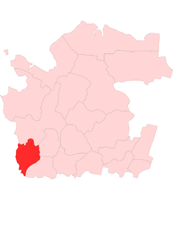
 Location of Kargopolsky District in Arkhangelsk Oblast |
|
| Coordinates: 61°30′N 38°56′E / 61.500°N 38.933°ECoordinates: 61°30′N 38°56′E / 61.500°N 38.933°E | |
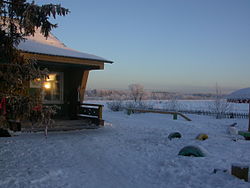
 Primary school in the village of Gavrilovskaya in Kargopolsky District |
|
| Location | |
| Country | Russia |
| Federal subject | Arkhangelsk Oblast |
| Administrative structure (as of 2012) | |
| Administrative center | town of Kargopol |
| Administrative divisions: | |
| Towns of district significance | 1 |
| Selsoviets | 12 |
| Inhabited localities: | |
| Cities/towns | 1 |
| Rural localities | 242 |
| Municipal structure (as of March 2012) | |
| Municipally incorporated as | Kargopolsky Municipal District |
| Municipal divisions: | |
| Urban settlements | 1 |
| Rural settlements | 5 |
| Statistics | |
| Area | 10,127 km2 (3,910 sq mi) |
| Population (2010 Census) | 18,466 inhabitants |
| • Urban | 55.3% |
| • Rural | 44.7% |
| Density | 1.82/km2 (4.7/sq mi) |
| Time zone | MSK (UTC+03:00) |
| Established | July 15, 1929 |
| Official website | |
| on | |
Kargopolsky District (Russian: Каргопо́льский райо́н) is an administrative district (raion), one of the twenty-one in Arkhangelsk Oblast, Russia. As a municipal division, it is incorporated as Kargopolsky Municipal District. It is located in the southwest of the oblast and borders with Plesetsky District in the north, Nyandomsky District in the northeast, Konoshsky District in the east, Kirillovsky District of Vologda Oblast in the south, Vytegorsky District, also of Vologda Oblast, in the southwest, and with Pudozhsky District of the Republic of Karelia in the northwest. The area of the district is 10,127 square kilometers (3,910 sq mi). Its administrative center is the town of Kargopol. Population: 18,466 (2010 Census);21,514 (2002 Census);24,589 (1989 Census). The population of Kargopol accounts for 55.3% of the district's total population.
The area was originally populated by the Finno-Ugric peoples and then colonized by the Novgorod Republic. Traditionally, the foundation of Kargopol is thought to be in 1146, although it was not first mentioned in the chronicles until the 14th century. In the 15th century, it was already a fortress, playing an important role in the struggle between Novgorod and the emerging power of Moscow. In particular, in 1447 the outlaw prince Dmitry Shemyaka, after being chased from Moscow by Vasily II, fled to Kargopol and stayed there for over a year. After the fall of Novgorod, the area became a part of the Grand Duchy of Moscow. In the 16th century, Kargopol was one of the biggest towns of Russia, and was mainly a merchant town due to its location on the road from Moscow to Arkhangelsk (at the time, the main Russian harbor for European trade). Kargopol was also used for political exile. For instance, Ivan Bolotnikov, the leader of the peasant insurgence, was sent to Kargopol in 1607, where he was blinded and then drowned. After St. Petersburg was built in 1703, the trade was rerouted to the Baltic Sea and the importance of Kargopol diminished.
...
Wikipedia
