Karatepe
 |
|
| Location | Osmaniye Province, Turkey |
|---|---|
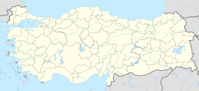
| Coordinates | 37°17′45″N 36°15′14″E / 37.29572521°N 36.25394787°ECoordinates: 37°17′45″N 36°15′14″E / 37.29572521°N 36.25394787°E |
| Type | Settlement |
| History | |
| Cultures | Hittite |
| Site notes | |
| Condition | In ruins |
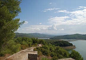
Karatepe (Turkish for "Black Hill"; Hittite: Azatiwataya) is a late Hittite fortress and open-air museum in Osmaniye Province in southern Turkey lying at a distance of about 23 km from the district center of Kadirli. It is sited in the Taurus Mountains, on the right bank of the Ceyhan River. The site is contained within Karatepe-Aslantaş National Park.
The place was an ancient city of Cilicia, which controlled a passage from eastern Anatolia to the north Syrian plain. It became an important Neo-Hittite center after the collapse of the Hittite Empire in the late 12th century BC. Relics found here include vast historic tablets, statues and ruins, even two monumental gates with reliefs on the sills depicting hunting and warring and a boat with oars; pillars of lions and sphinxes flank the gates.
The site's eighth-century BC bilingual inscription, in Phoenician and Hieroglyphic Luwian, reflects the activities of the kings of Adana from the "house of Mopsos", given in Hieroglyphic Luwian as mu-ka-sa- (often rendered as 'Moxos') and in Phoenician as Mopsos in the form mpš. It was composed in Phoenician and then translated to Hieroglyphic Luwian. This inscription has served archaeologists as a Rosetta stone for deciphering those glyphs.
As we learn from the inscription, its author is Azatiwada (or Azatiwata), the ruler of the town. He was also its founder; the inscription commemorates the town's foundation. He acknowledged himself as a subordinate of Awariku, the king of Adanawa (Adana), which was the ancient kingdom of Quwe. Azatiwataya seems to have been one of the frontier towns of Adanawa.
...
Wikipedia

