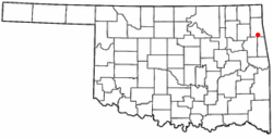
Kansas, Oklahoma
| Kansas, Oklahoma | |
|---|---|
| Town | |
 Location of Kansas, Oklahoma |
|
| Coordinates: 36°12′9″N 94°47′42″W / 36.20250°N 94.79500°WCoordinates: 36°12′9″N 94°47′42″W / 36.20250°N 94.79500°W | |
| Country | United States |
| State | Oklahoma |
| County | Delaware |
| Area | |
| • Total | 1.9 sq mi (4.8 km2) |
| • Land | 1.9 sq mi (4.8 km2) |
| • Water | 0.0 sq mi (0.0 km2) |
| Elevation | 1,145 ft (349 m) |
| Population (2010) | |
| • Total | 802 |
| • Density | 433/sq mi (167.1/km2) |
| Time zone | Central (CST) (UTC-6) |
| • Summer (DST) | CDT (UTC-5) |
| ZIP code | 74347 |
| Area code(s) | 539/918 |
| FIPS code | 40-38600 |
| GNIS feature ID | 1094286 |
Kansas is a town in Delaware County, Oklahoma, United States. The population was 802 at the 2010 census.
Kansas is located in southern Delaware County at 36°12′9″N 94°47′42″W / 36.20250°N 94.79500°W (36.202423, -94.795122).U.S. Route 412, the Cherokee Turnpike, bypasses the town to the north, with access from Exit 28 (U.S. Route 59) north of the east end of town. The turnpike leads west 69 miles (111 km) to Tulsa. To the east, US 412 and 59 lead 13 miles (21 km) to the Arkansas border at Siloam Springs. US 59 leads north from the town of Kansas 19 miles (31 km) to Jay, the Delaware County seat. Oklahoma State Highway 10 leads south 29 miles (47 km) to Tahlequah.
According to the United States Census Bureau, the town has a total area of 1.9 square miles (4.8 km2), all of it land.
As of the census of 2010, there were 802 people, 231 households, and 182 families residing in the town. The population density was 457.7 people per square mile (176.3/km²). There were 260 housing units at an average density of 173.7 per square mile (66.9/km²). The racial makeup of the town was 45.84% White, 46.42% Native American, 0.15% Pacific Islander, 0.15% from other races, and 7.45% from two or more races. Hispanic or Latino of any race were 1.17% of the population.
...
Wikipedia
