Kandi, Benin
| Kandi | |
|---|---|
| Commune, arrondissement and city | |
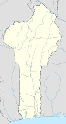
| Location in Benin | |
| Coordinates: 11°07′43″N 2°56′13″E / 11.12861°N 2.93694°ECoordinates: 11°07′43″N 2°56′13″E / 11.12861°N 2.93694°E | |
| Country |
|
| Department | Alibori Department |
| Area | |
| • Total | 3,421 km2 (1,321 sq mi) |
| Elevation | 288 m (945 ft) |
| Population (2013) | |
| • Total | 177,683 |
| • Density | 52/km2 (130/sq mi) |
| Time zone | WAT (UTC+1) |
| Postal address | BP: 30 |
| Area code(s) | (+229) 23 |
Kandi is a town, arrondissement and commune in the Alibori Department of eastern Benin. Originally a market town, Kandi is now primarily a farming centre. It lies on the nation's main north-south highway, 650 km from Cotonou and 325 miles (523 km) north of Porto-Novo. The town is the capital of the department of Alibori. The commune covers an area of 3421 square kilometres and as of 2013 had a population of 177,683 people. The town itself had a population of 27,227 in 2002.
Kandi was founded by the Dendi Kingdom, an offshoot of the Songhai Empire. The surrounded villages are Mokole Yoruba, who fled the wars of the foundation of the Oyo Kingdom. The surrounding countryside is Bariba.
The commune of Kandi is located 650 kilometres from Cotonou. Communally it is bounded to the north by Malanville, south by Gogounou, west by Banikoara and to the east with Ségbana.
Kandi is subdivided into 10 arrondissements; Kandi I, Kandi II, Kandi III, Angaradébou, Bensékou, Donwari, Kassakou, Saah, Sam and Sonsoro. They contain 39 villages and 9 urban districts.
...
Wikipedia

