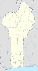
Banikoara
| Banikoara | |
|---|---|
| Commune, arrondissement and city | |
| Location in Benin | |
| Coordinates: 11°18′N 2°26′E / 11.300°N 2.433°ECoordinates: 11°18′N 2°26′E / 11.300°N 2.433°E | |
| Country |
|
| Department | Alibori Department |
| Area | |
| • Commune, arrondissement and city | 4,383 km2 (1,692 sq mi) |
| Elevation | 300 m (1,000 ft) |
| Population (2013) | |
| • Commune, arrondissement and city | 248,621 |
| • Density | 57/km2 (150/sq mi) |
| • Metro | 28,402 |
| Time zone | WAT (UTC+1) |
| Postal address | BP: 01 |
| Area code(s) | (+223) 29 |
Banikoara is a town, arrondissement and commune located in the Alibori Department of Benin. It lies 69 kilometers west of Kandi at the heart of the most productive cotton-growing region in Benin. Its name means "Bani's town," and honors its founder, Bani Gansé.
Banikoara is subdivided into 10 arrondissements; Banikoara, Founougo, Gomparou, Goumori, Kokey, Kokiborou, Ounet, Sompérékou, Soroko and Toura. They contain 53 villages and 11 urban districts.
The arrondissement of Banikoara contains the villages of Arbonga, Demanou, Derou Garou, Kokire, Kommon, Kori Ginguiri, Tokey Banta, Wagou, Weterou and Yadikparou.
The commune covers an area of 4383 square kilometres and as of 2002 had a population of 152,028 people. In 2008 there was an estimated 24,917 living in the main town.
Most of the population are engaged in agricultural activities followed by trade and handicrafts. 51 024,00 hectares of land are devoted to agriculture, accounting for 7.32% of the total land area. The main crops grown are maize, cotton, sorghum and cowpeas.
...
Wikipedia

