Kalusz
|
Kalush Калуш |
|||
|---|---|---|---|
| City of regional significance | |||
 |
|||
|
|||
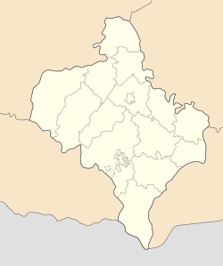
| Location of Kalush in Ivano-Frankivsk | |||
| Coordinates: 49°02′39″N 24°21′35″E / 49.04417°N 24.35972°ECoordinates: 49°02′39″N 24°21′35″E / 49.04417°N 24.35972°E | |||
| Country |
|
||
| Region | Ivano-Frankivsk | ||
| Established | March 20, 1972 | ||
| Subdivisions |
List
|
||
| Area | |||
| • Total | 65 km2 (25 sq mi) | ||
| Population (2016) | |||
| • Total | 67,519 | ||
| • Density | 1,000/km2 (2,700/sq mi) | ||
| Time zone | EET (UTC+2) | ||
| • Summer (DST) | EEST (UTC+3) | ||
| Area code | 380 3472- | ||
| Website | http://kalush.net | ||
Kalush (Ukrainian: Калуш, Polish: Kałusz, translit. Kalush) is a city set in the foothills of the Carpathian Mountains, in the Ivano-Frankivsk Oblast (province) of western Ukraine.
It is administratively incorporated as a town of oblast significance and serves as the administrative centre of the surrounding Kalush Raion (district), which it is administratively not a part of. Population: 67,519 (2016 est.).
Important local industries include chemicals and concrete. The city is notorious for its bleaching products that locally became referred to as kalushanka.
The city is located in western portion of the Ivano-Frankivsk Oblast, within the region of Western Ukraine at the foothills of Carpathian Mountains. Kalush stands on the Dniester tributary, Limnytsia River that takes its beginning from the slopes of Carpathians. The city is located at the eastern borders of ethnographical region of Boyko Land.
The earliest known mention of Kalush is the accounting of a village of that name in a chronicle dated May 27, 1437. At that time, together with whole Red Ruthenia, the village belonged to the Kingdom of Poland, and was known under its Polish name, Kałusz. Until the mid-16th century Kałusz was part of Halicz Land, Ruthenian Voivodeship. It was known for producing malt, its brewery and salt mining, and was royal village, where in 1469 King Kazimierz Jagiellonczyk founded a Roman Catholic parish church.
...
Wikipedia


