Kafr Kanna
Kafr Kanna
|
|
|---|---|
| Hebrew transcription(s) | |
| • ISO 259 | Kpar Kannaˀ |
| • Also spelled | Kafar Kanna (official) Kufr Kana (unofficial) |
| Coordinates: 32°45′N 35°21′E / 32.750°N 35.350°ECoordinates: 32°45′N 35°21′E / 32.750°N 35.350°E | |
| Grid position | 182/239 PAL |
| District | Northern |
| Government | |
| • Type | Local council (from 1968) |
| • Head of Municipality | Mujahed Awawdeh |
| Area | |
| • Total | 10,600 dunams (10.6 km2 or 4.1 sq mi) |
| Population (2015) | |
| • Total | 21,296 |
| Name meaning | "Village of Cana" |
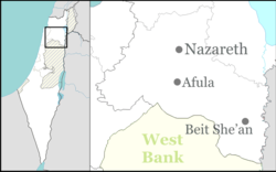
Kafr Kanna (Arabic: كفر كنا, Kafr Kanā; Hebrew: כַּפְר כַּנָּא) is an Arab town, in Galilee, part of the Northern District of Israel. It is associated with the New Testament village of Cana, where Jesus turned water into wine. In 2015 its population was 21,296.
Archaeological excavations by the Israel Antiquities Authority uncovered remains dating from the Neolithic to the Mamluk periods. Evidence for a large Early Bronze Age settlement was excavated adjacent to the perennial Kanna spring, overlaying a site dating to the Early Chalcolithic Period. A fortification wall indicates that the settlement was fortified.
Kana was mentioned in the Amarna letters, and was known in the times of the Roman-Jewish historian Josephus.
On the outskirts of the modern town is the tomb of the Jewish sage, rabbi Simeon ben Gamliel, the Nasi (prince) of the Sanhedrin (legislative body of Ancient Israel), who became president of the Sanhedrin in 50 CE. His tomb has remained a Jewish pilgrimage site over the centuries.
Nasir-i-Khusraw visited the village in 1047 CE and described the place in his diary:
...
Wikipedia

