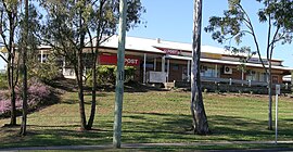
Jimboomba
|
Jimboomba Logan City, Queensland |
|||||||||||||
|---|---|---|---|---|---|---|---|---|---|---|---|---|---|

The post office and veterinary surgery, Jimboomba.
|
|||||||||||||
| Coordinates | 27°50′S 153°02′E / 27.833°S 153.033°ECoordinates: 27°50′S 153°02′E / 27.833°S 153.033°E | ||||||||||||
| Population | 11,387 (2011 census) | ||||||||||||
| • Density | 2,588/km2 (6,700/sq mi) | ||||||||||||
| Established | 1845 | ||||||||||||
| Postcode(s) | 4280 | ||||||||||||
| Area | 4.4 km2 (1.7 sq mi) | ||||||||||||
| Location | 41 km (25 mi) south of Brisbane CBD | ||||||||||||
| LGA(s) | Logan City | ||||||||||||
| State electorate(s) | Beaudesert | ||||||||||||
| Federal Division(s) | Wright | ||||||||||||
|
|||||||||||||
Jimboomba is a growing town and locality in Logan City, Queensland, Australia. In the 2011 census, Jimboomba had a population of 11,387 people.
The original spelling was Gimboomba, named after a sheep and livestock station based where the township is today, stretching some distance north, east and south to neighbouring areas. Gimboomba is a Gugingin word (the First Australian peoples of the area, of Yugambeh country) meaning place of loud thunder and little rain. A culture trail celebrating First Australian culture is based at a local primary school bearing the name 'Loud Thunder' paying respect to its traditional owners.
Jimboomba Provisional School opened on 12 May 1890, becoming Jimboomba State School on 1 June 1900.
Jimboomba was serviced by the Beaudesert railway line that was established to service the abattoir in Beaudesert. The line was closed in 1995 and then reopened and operated as a tourist service as far as Logan Village by railway enthusiasts from 1999 until mid-2004. Funds were harder to raise and depleted quickly for the line so it was closed permanently.
Formerly in the Shire of Beaudesert, Jimboomba became part of Logan City following the local government amalgamations in March 2008.
Jimboomba is situated on the Mount Lindesay Highway, 47 kilometres (29 mi) south of Brisbane central business district. The eastern and western parts of Jimboomba are divided by the Logan River; the only bridge within the locality is Payne Bridge on Cusack Lane (27°49′14″S 153°00′15″E / 27.82068°S 153.00428°E). There is a low-level older bridge immediately to the north of Payne Bridge but this cannot be used by vehicular traffic.
...
Wikipedia

