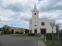
Jevišovka
| Jevišovka | |||
|---|---|---|---|
| Municipality | |||
 |
|||
|
|||
| Coordinates: 48°50′15″N 16°27′24″E / 48.83750°N 16.45667°ECoordinates: 48°50′15″N 16°27′24″E / 48.83750°N 16.45667°E | |||
| Country |
|
||
| Region | South Moravian | ||
| District | Břeclav | ||
| Area | |||
| • Total | 12.64 km2 (4.88 sq mi) | ||
| Elevation | 177 m (581 ft) | ||
| Population (1.1.2012) | |||
| • Total | 627 | ||
| • Density | 50/km2 (130/sq mi) | ||
| Postal code | 691 83 | ||
| Website | http://www.jevisovka.cz | ||
Jevišovka, formerly Frélichov (German: Fröllersdorf, Croatian: Frjelištorf, Frielištof) is a village and municipality (obec) in Břeclav District in the South Moravian Region of the Czech Republic.
The municipality covers an area of 12.64 square kilometres (4.88 sq mi), and has a population of 568 (as at 3 July 2006).
Jevišovka lies on the confluence of Jevišovka and Dyje rivers, approximately 33 kilometres (21 mi) west of Břeclav, 42 km (26 mi) south of Brno, and 203 km (126 mi) south-east of Prague.
In the past a large Croatian community lived in the village (74% in 1930). There was also a minority of Germans (17% in 1930). The Germans were expelled after World War II and Croats were also forcibly relocated in 1948.
...
Wikipedia


