Jasper County, South Carolina
| Jasper County, South Carolina | |
|---|---|

|
|
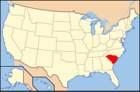
 Location in the U.S. state of South Carolina |
|
 South Carolina's location in the U.S. |
|
| Founded | 1912 |
| Seat | Ridgeland |
| Largest city | Hardeeville |
| Area | |
| • Total | 699 sq mi (1,810 km2) |
| • Land | 655 sq mi (1,696 km2) |
| • Water | 44 sq mi (114 km2), 6.3% |
| Population | |
| • (2010) | 24,777 |
| • Density | 38/sq mi (15/km²) |
| Congressional district | 6th |
| Time zone | Eastern: UTC-5/-4 |
| Website | www |
Jasper County is the southernmost county in the U.S. state of South Carolina. As of the 2010 census, the population was 24,777. Its county seat is Ridgeland. The county was formed in 1912 from portions of Hampton County and Beaufort County.
Jasper County is included in the Hilton Head Island-Bluffton-Beaufort, SC Metropolitan Statistical Area. It is located in the Lowcountry region of the state. For several decades, in contrast to neighboring Beaufort County, Jasper was one of the poorest counties in the state. Recent development from 2000 onwards has given the county new residents, expanded business opportunities, and a wealthier tax base. Since 2010, Jasper County is the second-fastest-growing county by population in South Carolina, behind Horry County.
According to the U.S. Census Bureau, the county has a total area of 699 square miles (1,810 km2), of which 655 square miles (1,700 km2) is land and 44 square miles (110 km2) (6.3%) is water.
As of the census of 2000, there were 20,678 people, 7,042 households, and 5,091 families residing in the county. The population density was 32 people per square mile (12/km²). There were 7,928 housing units at an average density of 12 per square mile (5/km²). The racial makeup of the county was 42.39% White, 52.69% Black or African American, 0.37% Native American, 0.44% Asian, 0.05% Pacific Islander, 3.39% from other races, and 0.67% from two or more races. 5.75% of the population were Hispanic or Latino of any race.
...
Wikipedia
