Beaufort County, South Carolina
| Beaufort County, South Carolina | ||
|---|---|---|

|
||
|
||
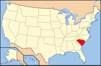
 Location in the U.S. state of South Carolina |
||
 South Carolina's location in the U.S. |
||
| Founded | 1769 | |
| Seat | Beaufort | |
| Largest town | Hilton Head Island | |
| Area | ||
| • Total | 923 sq mi (2,391 km2) | |
| • Land | 576 sq mi (1,492 km2) | |
| • Water | 347 sq mi (899 km2), 38% | |
| Population (est.) | ||
| • (2015) | 179,589 | |
| • Density | 282/sq mi (109/km²) | |
| Congressional districts | 1st, 6th | |
| Time zone | Eastern: UTC-5/-4 | |
| Website | www |
|
Beaufort County (/ˈbjuːfərt/ BEW-fərt) is a county in the U.S. state of South Carolina. As of the 2010 census, its population was 162,233. Its county seat is Beaufort.
Beaufort County is part of the Hilton Head Island-Bluffton-Beaufort, SC Metropolitan Statistical Area.
Beaufort County is one of the South's fastest-growing counties,[1] primarily because of development south of the Broad River clustered along the U.S. Highway 278 corridor. The county's northern portions have also grown steadily, due in part to the strong federal military presence around the city of Beaufort.
The county's two portions are connected by the Broad River Bridge, which carries South Carolina Highway 170. Despite the connectivity, often the "north of Broad" and "south of Broad" populations of the county find each other at odds over county-wide issues dealing with growth management.
...
Wikipedia

