Jackson County, Alabama
| Jackson County, Alabama | |
|---|---|

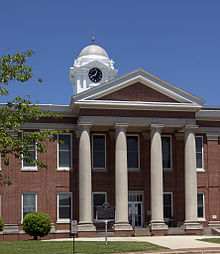
Jackson County courthouse in Scottsboro
|
|
 Location in the U.S. state of Alabama |
|
 Alabama's location in the U.S. |
|
| Founded | December 13, 1819 |
| Named for | Andrew Jackson |
| Seat | Scottsboro |
| Largest city | Scottsboro |
| Area | |
| • Total | 1,127 sq mi (2,919 km2) |
| • Land | 1,078 sq mi (2,792 km2) |
| • Water | 49 sq mi (127 km2), 4.3% |
| Population (est.) | |
| • (2015) | 52,419 |
| • Density | 49/sq mi (19/km²) |
| Congressional district | 5th |
| Time zone | Central: UTC-6/-5 |
| Website | www |
|
Footnotes:
|
|
Footnotes:
Jackson County is the northeasternmost county in the U.S. state of Alabama. As of the 2010 census, the population was 53,227. The county seat is Scottsboro. It was named for Andrew Jackson, general in the United States Army and afterward President of the United States of America. Jackson County is a prohibition or dry county, however three cities within the county (Bridgeport, Scottsboro, and Stevenson) are wet.
Jackson County comprises the Scottsboro, AL Micropolitan Statistical Area, which is also included in the Chattanooga-Cleveland-Dalton, TN-GA-AL Combined Statistical Area.
Jackson County was established on December 13, 1819.
According to the U.S. Census Bureau, the county has a total area of 1,127 square miles (2,920 km2), of which 1,078 square miles (2,790 km2) is land and 49 square miles (130 km2) (%) is water. It is the fifth-largest county in Alabama by total area. Much of it is located in the Appalachians.
...
Wikipedia
