Jōshin'etsu-kōgen National Park
| Jōshin'etsu-kōgen National Park | |
|---|---|
| 上信越高原国立公園 | |
|
IUCN category II (national park)
|
|

|
|
| Location | Honshū, Japan |
| Coordinates | 36°37′30″N 138°37′30″E / 36.62500°N 138.62500°ECoordinates: 36°37′30″N 138°37′30″E / 36.62500°N 138.62500°E |
| Area | 1,890.62 square kilometres (729.97 sq mi) |
| Established | September 7, 1949 |
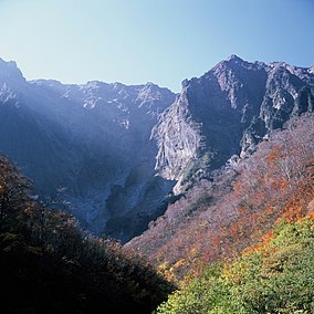
Jōshin'etsu-kōgen National Park (上信越高原国立公園 Jōshin'etsu-kōgen Kokuritsu Kōen?) is a national park in the Chūbu region of the main island of Honshū, Japan formed around several active and dormant volcanoes. The park spans the mountainous areas of Gunma, Nagano, and Niigata prefectures. The name of the park refers to the two mountain ranges that makes up the park. It is divided into two separate areas: the Southern Niigata/North Nagano Area and the East Nagano Area. Jōshin'etsu-kōgen National Park was established in 1949, and significantly expanded in 1956 to include the Myōkō-Togakushi mountainous region.
The name of the park consists of two elements. The first, "Jōshin'etsu", is a kanji acronym consisting of three characters which represent the former names of provinces of the area: Kōzuke Province (上野国?) in present-day Gunma Prefecture, Shinano Province (信濃国?) in present-day Nagano Prefecture, and Echigo Province (越後国?) in present-day Niigata Prefecture. The second, "kōgen", means tableland or plateau.
...
Wikipedia
