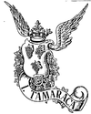
Itamaracá
|
|||||||||||||||||||||||||||||||||||||||||||||||||
|
|||||||||||||||||||||||||||||||||||||||||||||||||
|
Ilha de Itamaracá Município de Ilha de Itamaracá |
|||
|---|---|---|---|
| Municipality | |||

Forte Orange, Ilha de Itamaracá, Pernambuco, Brasil
|
|||
|
|||
| Nickname(s): "Beleza Natural" "Capital da Ciranda |
|||
 Location of Ilha de Itamaracá in Pernambuco |
|||
| Location of Ilha de Itamaracá in Brazil | |||
| Coordinates: 07°44′50″S 34°49′40″W / 7.74722°S 34.82778°WCoordinates: 07°44′50″S 34°49′40″W / 7.74722°S 34.82778°W | |||
| Country |
|
||
| Region | Northeast | ||
| State |
|
||
| Founded | December 31, 1958 | ||
| Government | |||
| • Mayor | Paulo Batista (PTB, 2013-2016) | ||
| Area | |||
| • Total | 66.68 km2 (25.75 sq mi) | ||
| Elevation | 3 m (10 ft) | ||
| Population (2014) | |||
| • Total | 24,413 | ||
| • Density | 370/km2 (950/sq mi) | ||
| Demonym(s) | Itamaracaense | ||
| Time zone | BRT (UTC-3) | ||
| Website | ilhadeitamaraca |
||
| Native name: Ilha de Itamaracá | |
|---|---|
| Dutch map of Itamaracá Island, 1648 | |
| Geography | |
| Location | Atlantic Ocean |
| Administration | |
|
Brazil
|
|
| State | Pernambuco |
| Municipality | Itamaracá |
Ilha de Itamaracá is an island and municipality in Pernambuco, Brazil on the Atlantic Ocean. Itamaracá means "stone shaker" in Tupi, from the words itá ("stone") and mbara'ká ("shaker"). It is separated from the mainland by the Canal de Santa Cruz, a salt water channel both mouths of which are on the Atlantic Ocean.
Itamaracá has a total area of 66.68 square kilometres (25.75 sq mi) and had an estimated population of 24,413 inhabitants in 2014 according to IBGE. It is located in the metropolitan area of Recife, the capital city of Pernambuco state. The main activities of the population are fishing and tourism. Recife is located about 38 kilometres (24 mi) to the south whereas Olinda, another important town of Pernambuco and also UNESCO World Heritage, is 30 kilometres (19 mi) to the south.
In the early 1500s before Portuguese colonization, the island was the site of a trading post for furs and other native goods, and transhipment depot for Brazilwood. The island at that time was occupied by various loosely related tribes of Tupi-Guarani native South American peoples. Later, the island became part of the Captaincy of Itamaracá (most of which today is occupied by the state of Paraiba) which took its name from the island, established by King John III of Portugal in 1534. The chief economic activity in the following century and a half was sugar cane processing, in engenhos (sugar mills). While Itamaracá was administratively separate, it operated as a political and economic subdivision of Pernambuco. With the rise of the gold economy in the late 17th century, Itamaracá became economically isolated.
Itamaracá is renowned for having one of the first, if not the first, Jewish community in the Americas. In the Yosef Goldman Collection, there is a book titled Sefer Shefa Tal, a kabbalistic volume that was printed in Hanau, Germany, in 1612. It contains a handwritten statement of ownership by Rabbi Jacob Lagarto of a congregation in Tamarica, Brazil. Rabbi Lagarto came to Brazil as a young man and was the author of a volume of aphorisms (copies of which, evidently, no longer exist). The book is the only known physical link to this Jewish community, since there are no other known artifacts from it.
...
Wikipedia


