Itō, Shizuoka
|
Itō 伊東市 |
|||
|---|---|---|---|
| City | |||

Aerial View of Itō
|
|||
|
|||
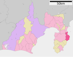
 Location of Itō in Shizuoka Prefecture |
|||
| Coordinates: 34°57′56.6″N 139°06′6.7″E / 34.965722°N 139.101861°ECoordinates: 34°57′56.6″N 139°06′6.7″E / 34.965722°N 139.101861°E | |||
| Country | Japan | ||
| Region | Chūbu (Tōkai) | ||
| Prefecture | Shizuoka Prefecture | ||
| Area | |||
| • Total | 124.10 km2 (47.92 sq mi) | ||
| Population (September 2015) | |||
| • Total | 68,541 | ||
| • Density | 552/km2 (1,430/sq mi) | ||
| Time zone | Japan Standard Time (UTC+9) | ||
| - Tree | Camellia | ||
| - Flower | Camellia | ||
| - Bird | Blue Rock-thrush | ||
| Phone number | 0557-36-0111 | ||
| Address | 2-1-1 Ōhara, Ito-shi, Shizuoka-ken 414-8555 | ||
| Website | www |
||
Itō (伊東市 Itō-shi?) is a city located on the eastern shore of the Izu Peninsula in Shizuoka Prefecture, Japan.
As of September 2015, the city had an estimated population of 68,541 and a population density of 552 persons per km². The total area was 124.13 square kilometres (47.93 sq mi). Much of the city is part of the Fuji-Hakone-Izu National Park.
Itō is located in eastern Shizuoka Prefecture, on the northeast corner of Izu Peninsula, facing Sagami Bay on the Pacific Ocean. The landscape is hilly, and Its heavily indented coastline is a scenic area. The climate of Itō is temperate maritime, with hot humid summers, and short, cool winters.
Shizuoka Prefecture
During the Edo period, all of Izu Province was tenryō territory under direct control of the Tokugawa shogunate, and the area now comprising Itō was occupied by 15 small farming and fishing hamlets. It was in this area that the Tokugawa Shogunate ordered Englishman William Adams to construct Japan's first western-style sailing vessels in 1604. The first ship, an 80-ton vessel, was used for surveying work, and the second ship, the 120-ton San Buena Ventura was sailed to Mexico. The period is commemorated in Itō by a street named after Adams (Anjinmiuradori). The area was reorganized into four villages (Tsushima, Itō, Komuro and Usami) within Kamo District the cadastral reform of the early Meiji period in 1889, and were transferred to Tagata District in 1896. On January 1, 1906 the village of Itō was elevated to town status. It annexed neighboring Komuro Village on August 10, 1947 and became the city of Itō. In 1950 Itō was proclaimed an "International Tourism and Cultural City" by the central government. It further expanded through annexation of neighboring Tsushima and Usami villages on April 1, 1955.
...
Wikipedia


