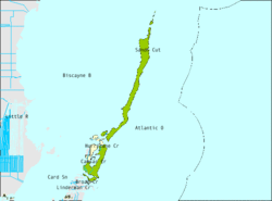
Islandia, Florida
| Islandia, Florida | |
|---|---|
| Unincorporated Community | |
 Location in Miami-Dade County and the state of Florida |
|
 U.S. Census Bureau map showing limits of former city |
|
| Coordinates: 25°23′18″N 80°14′10″W / 25.38833°N 80.23611°WCoordinates: 25°23′18″N 80°14′10″W / 25.38833°N 80.23611°W | |
| Country |
|
| State |
|
| County | Miami-Dade |
| Area | |
| • Total | 66.4 sq mi (171.9 km2) |
| • Land | 6.5 sq mi (16.7 km2) |
| • Water | 59.9 sq mi (155.2 km2) |
| Elevation | 3 ft (1 m) |
| Population (2010) | |
| • Total | 18 |
| • Density | 0.27/sq mi (0.10/km2) |
| Time zone | Eastern (EST) (UTC-5) |
| • Summer (DST) | EDT (UTC-4) |
| FIPS code | 12-34175 |
| GNIS feature ID | 0304638 |
Islandia is a unincorporated community and former city in Miami-Dade County, Florida, United States, located on Elliott Key and other nearby keys, such as Totten Key. The population was 18 at the 2010 Census. Most residents of the city were National Park Service employees.
In the 2010 Primary Election, the Miami-Dade County Commission was empowered via a charter amendment to abolish Islandia. On December 6, 2011, Miami-Dade County Commissioners unanimously approved an ordinance to abolish the city, with final action to be taken after a public hearing. Following a public hearing, the ordinance abolishing Islandia received final approval on March 6, 2012, and took effect on March 16, 2012.
Islandia, and in particular Elliott Key, was originally fished by the Native American Tequesta people. It subsequently became a haven for shipwreck survivors. By the mid-1800s, a group of Bahamians had made their way to the key, where they unsuccessfully tried farming on an island with a base of coral rock. By the early 1900s, Islandia had its own school district and more than 100 residents. However, the number of residents dwindled over time due to the lack of electricity, poor farming, and the relatively long distance from the mainland.
In 1950 the Dade County Planning Board announced a plan to build a highway connecting Key Biscayne with the Overseas Highway on Key Largo. The project envisioned a series of bridges connecting artificial islands, to be built on the Safety Valve, and existing small keys to Elliott Key and on to Key Largo. When the Dade County Planning Board was unable to secure a right of way for the highway across the southern end of Key Biscayne, it dropped the plan.
...
Wikipedia
