Iron River, Michigan
| Iron River, Michigan | |
|---|---|
| City | |
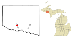
 Location of Iron River, Michigan |
|
| Coordinates: 46°5′47″N 88°38′26″W / 46.09639°N 88.64056°W | |
| Country | United States |
| State | Michigan |
| County | Iron |
| Area | |
| • Total | 6.76 sq mi (17.51 km2) |
| • Land | 6.74 sq mi (17.46 km2) |
| • Water | 0.02 sq mi (0.05 km2) |
| Elevation | 1,512 ft (461 m) |
| Population (2010) | |
| • Total | 3,029 |
| • Estimate (2015) | 2,904 |
| • Density | 449.4/sq mi (173.5/km2) |
| Time zone | Central (CST) (UTC-6) |
| • Summer (DST) | CDT (UTC-5) |
| ZIP code | 49935 |
| Area code(s) | 906 |
| FIPS code | 26-40980 |
| GNIS feature ID | 1620325 |
Iron River is a city in Iron County in the U.S. state of Michigan. As of the 2010 census, the city population was 3,029. The city is situated at the southeast corner of Iron River Township, but is administratively autonomous.
A post office called Iron River has been in operation since 1885. The city took its name from the nearby Iron River.
On July 1, 2000, the city of Stambaugh and the village of Mineral Hills were consolidated with the City of Iron River.
According to the United States Census Bureau, the city has a total area of 6.76 square miles (17.51 km2), of which 6.74 square miles (17.46 km2) is land and 0.02 square miles (0.05 km2) is water.
The area is noted for its vast forest land, scenic lakes, and winter sports.
As of the census of 2010, there were 3,029 people, 1,446 households, and 764 families residing in the city. The population density was 449.4 inhabitants per square mile (173.5/km2). There were 1,770 housing units at an average density of 262.6 per square mile (101.4/km2). The racial makeup of the city was 96.3% White, 0.2% African American, 1.2% Native American, 0.3% Asian, 0.1% Pacific Islander, 0.2% from other races, and 1.7% from two or more races. Hispanic or Latino of any race were 1.9% of the population.
...
Wikipedia
