Irafsky District
| Irafsky District Ирафский район (Russian) Æрæфы район (Ossetic) |
|
|---|---|
 Location of Irafsky District in the Republic of North Ossetia–Alania |
|
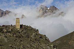
 Mountains in Alaniya National Park, Irafsky District |
|
| Location | |
| Country | Russia |
| Federal subject | Republic of North Ossetia–Alania |
| Administrative structure (as of January 2011) | |
| Administrative center | selo of Chikola |
| Administrative divisions: | |
| rural okrug | 14 |
| Inhabited localities: | |
| Rural localities | 36 |
| Municipal structure (as of January 2006) | |
| Municipally incorporated as | Irafsky Municipal District |
| Municipal divisions: | |
| Urban settlements | 0 |
| Rural settlements | 14 |
| Statistics | |
| Area | 1,376 km2 (531 sq mi) |
| Population (2010 Census) | 15,766 inhabitants |
| • Urban | 0% |
| • Rural | 100% |
| Density | 11.46/km2 (29.7/sq mi) |
| Time zone | MSK (UTC+03:00) |
| Official website | |
| on | |
Irafsky District (Russian: Ира́фский райо́н; Ossetian: Æрæфы район) is an administrative and municipal district (raion), one of the eight in the Republic of North Ossetia–Alania, Russia. It is located in the west of the republic. The area of the district is 1,376 square kilometers (531 sq mi). Its administrative center is the rural locality (a selo) of Chikola. Population: 15,766 (2010 Census); 15,708 (2002 Census);15,732 (1989 Census). The population of Chikola accounts for 44.5% of the district's total population.
Coordinates: 43°11′29″N 43°55′06″E / 43.19139°N 43.91833°E
...
Wikipedia
