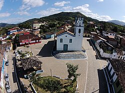
Iporanga
| Iporanga | |||
|---|---|---|---|
| Municipality | |||
 |
|||
|
|||
 Location in São Paulo state |
|||
| Location in Brazil | |||
| Coordinates: 24°35′08″S 48°35′35″W / 24.58556°S 48.59306°WCoordinates: 24°35′08″S 48°35′35″W / 24.58556°S 48.59306°W | |||
| Country |
|
||
| Region | Southeast Region | ||
| State | São Paulo | ||
| Area | |||
| • Total | 1,152 km2 (445 sq mi) | ||
| Elevation | 81 m (266 ft) | ||
| Population (2015) | |||
| • Total | 4,333 | ||
| • Density | 3.8/km2 (9.7/sq mi) | ||
| Time zone | BRT/BRST (UTC-3/-2) | ||
Iporanga is a municipality in the state of São Paulo in Brazil. The population is 4,333 (2015 est.) in an area of 1152 km². The elevation is 81 m.
Iporanga contains parts of the Alto Ribeira and Baixo Ribeira sub-basins of the Ribeira de Iguape River basin. The municipality contains part of the 488,865 hectares (1,208,010 acres) Serra do Mar Environmental Protection Area, created in 1984. It contains part of the 41,704 hectares (103,050 acres) Intervales State Park, created in 1995. It contains part of the 40,175 hectares (99,270 acres) Caverna do Diabo State Park, created in 2008. It contains 55% of the 64,625 hectares (159,690 acres) Quilombos do Médio Ribeira Environmental Protection Area, established in 2008.
...
Wikipedia


