Iosco County, Michigan
| Iosco County, Michigan | ||
|---|---|---|
|
||
 Location in the U.S. state of Michigan |
||
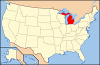
 Michigan's location in the U.S. |
||
| Founded | 1840, organized in 1857 | |
| Seat | Tawas City | |
| Largest city | East Tawas | |
| Area | ||
| • Total | 1,890 sq mi (4,895 km2) | |
| • Land | 549 sq mi (1,422 km2) | |
| • Water | 1,341 sq mi (3,473 km2), 71% | |
| Population | ||
| • (2010) | 25,887 | |
| • Density | 47/sq mi (18/km²) | |
| Congressional district | 5th | |
| Time zone | Eastern: UTC-5/-4 | |
| Website | iosco |
|
Iosco County is a county in the U.S. state of Michigan. As of the 2010 census, the population was 25,887. The county seat is Tawas City.
Iosco is traditionally said to be a Native American word meaning "water of light," though it is actually a pseudo-Native American name coined by Henry Schoolcraft, a Michigan geographer and ethnologist.
The county was created by the Michigan Legislature in 1840 as Kanotin County, and renamed Iosco County in 1843. It was administered by a succession of other Michigan counties prior to the organization of county government in 1857.
According to the U.S. Census Bureau, the county has an area of 1,890 square miles (4,900 km2), of which 549 square miles (1,420 km2) is land and 1,341 square miles (3,470 km2) (71%) is water. The county is considered to be part of Northern Michigan.
As of the census of 2000, there were 27,339 people, 11,727 households, and 7,857 families residing in the county. The population density was 50 people per square mile (19/km²). There were 20,432 housing units at an average density of 37 per square mile (14/km²). The county's racial makeup was 96.92% White, 0.41% Black or African American, 0.66% Native American, 0.46% Asian, 0.05% Pacific Islander, 0.23% from other races, and 1.27% from two or more races. 0.98% of the population were Hispanic or Latino of any race. 23.2% were of German, 12.3% English, 10.6% Irish, 9.9% American, 8.3% Polish and 7.1% French ancestry according to Census 2000. 97.4% spoke English and 1.0% Spanish as their first language.
...
Wikipedia

