Invercargil
|
Invercargill Waihōpai (Māori) |
|
|---|---|

Spring in Esk Street, Invercargill
|
|
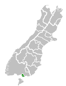
 Invercargill City's location within the South Island |
|
| Coordinates: 46°24′47″S 168°20′51″E / 46.41306°S 168.34750°E | |
| Country |
|
| Island | South Island |
| Region | Southland |
| Territorial authority | Invercargill City |
| Settled by Europeans | 1853 |
| Government | |
| • Mayor | Tim Shadbolt |
| • Deputy Mayor | Rebecca Amundsen |
| Area | |
| • Territorial | 389 km2 (150 sq mi) |
| • Urban | 115 km2 (44 sq mi) |
| Population (June 2016) | |
| • Territorial | 54,700 |
| • Density | 140/km2 (360/sq mi) |
| • Urban | 50,700 |
| • Urban density | 440/km2 (1,100/sq mi) |
| Demonym(s) | Invercargillite |
| Time zone | NZST (UTC+12) |
| • Summer (DST) | NZDT (UTC+13) |
| Postcode(s) | 9810, 9812 |
| Area code(s) | 03 |
| Local iwi | Ngāi Tahu |
| Website | icc |
Invercargill (Māori: Waihōpai) is the southernmost and westernmost city in New Zealand, and one of the southernmost cities in the world. It is the commercial centre of the Southland region. It lies in the heart of the wide expanse of the Southland Plains on the Oreti or New River some 18 km north of Bluff, which is the southernmost town in the South Island. It sits amid rich farmland that is bordered by large areas of conservation land and marine reserves, including Fiordland National Park covering the south-west corner of the South Island and the Catlins coastal region.
Many streets in the city, especially in the centre and main shopping district, are named after rivers in Great Britain, mainly Scotland. These include the main streets Dee and Tay, as well as those named after the Forth, Tyne, Esk, Don, Thames, Mersey, Ness, Yarrow, Spey and Eye rivers.
The 2013 census showed the population was 51,696, up 2.7% on the 2006 census number.
Southland was a scene of early extended contact between Europeans and Maori, notably whalers and missionaries – Wohlers at Ruapuke. In 1853, Walter Mantell purchased Murihiku from local Maori iwi, claiming the land for European settlement. Otago, of which Southland was itself part, was the subject of planned settlement by the Free Church, an offshoot of the Presbyterian Church of Scotland. Settlement broadened with the discovery of gold in Central Otago in the 1860s. Today, traces of Scottish speech persist in Southland voices, with R often pronounced with a rolling burr. This is more noticeable among country people.
...
Wikipedia
