Interstate 440 in North Carolina
| Interstate 440 | ||||
|---|---|---|---|---|
| Cliff Benson Beltline Raleigh Beltline |
||||
 |
||||
| Route information | ||||
| Maintained by NCDOT | ||||
| Length: | 16.40 mi (26.39 km) | |||
| Existed: | 1991 – present | |||
| Major junctions | ||||
| West end: |
|
|||
| East end: |
|
|||
| Location | ||||
| Counties: | Wake | |||
| Highway system | ||||
|
||||
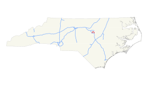
Interstate 440 (I-440), also known as the Raleigh Beltline, the Cliff Benson Beltline, or locally as just The Beltline, is an Interstate Highway in the US state of North Carolina. I-440 is a 16.4-mile-long (26.4 km) partial beltway that nearly encircles central Raleigh. I-440 begins in west Raleigh at an interchange with I-40, as a continuation of US Highway 64 (US 64)/US 1 and traverses a primarily residential area in west Raleigh. The freeway makes a turn toward the east, crossing US 70, Six Forks Road, and Wake Forest Road. US 1 branches north off of I-440 at Capital Boulevard (US 401), becoming US 401/US 1. I-440 turns toward the southeast and follows a brief concurrency with US 64 Business before intersecting I-495/US 64/US 264. US 64 is concurrent with I-440 along the remainder of the road's southwesterly routing. Exit 16 is the last exit on I-440, where I-440 splits to become I-40 East and West.
I-440 was commissioned in 1991 along the Raleigh Beltline, pieces of which had been constructed since the late 1950s, with the first section opening between 1959 and 1960. The loop was completed in 1984 under multiple route designations. To avoid confusion along the beltline, I-440 was routed along the entirety of the beltline and shared a concurrency with its parent, Interstate 40, along the loop's southern segment (Tom Bradshaw Freeway). In 2008, the I-440 designation was removed from the section of I-40/US 64 in southeast Raleigh. The highway's original "inner" and "outer" designations were also removed and replaced with compass directions (e.g. east/west).
...
Wikipedia

