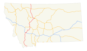
Interstate 15 in Montana
| Interstate 15 | |
|---|---|
 |
|
| Route information | |
| Maintained by Montana Department of Transportation | |
| Length: | 397.50 mi (639.71 km) |
| Major junctions | |
| South end: |
|
|
|
|
| North end: |
|
| Highway system | |
In the U.S. state of Montana, Interstate 15 continues onward from Idaho for nearly 400 miles (640 km) through the cities of Butte, Helena and Great Falls, intersecting with Interstate 90, Interstate 115 and Interstate 315. Interstate 15 reaches its northern terminus at the international border with Alberta, Canada.
Interstate 15 joins with I-90 and makes a junction with a short, one-mile (1.6 km) spur route Interstate 115 in Butte.
I-15 crosses into Montana from Idaho just south of Lima Reservoir, before the route continues northwest through farmland and desert. The freeway turns north at Clark Canyon Reservoir, before turning northeast. In the town of Dillon, I-15 passes near Clark's Lookout State Park before beginning to parallel the Big Hole River. The freeway then turns away from the river, continuing northeast along Divide Creek through the desert, before splitting away from the creek and heading north. I-15 eventually merges into I-90 at a trumpet interchange.
...
Wikipedia

