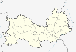
Insar, Insarsky District, Republic of Mordovia
| Insar (English) Инсар (Russian) Инзара (Moksha) |
|
|---|---|
| - Town - | |
 Location of the Republic of Mordovia in Russia |
|
|
|
|
|
|
|
|
|
|
| Administrative status (as of September 2014) | |
| Country | Russia |
| Federal subject | Republic of Mordovia |
| Administrative district | Insarsky District |
| Town of district significance | Insar |
| Administrative center of | Insarsky District, town of district significance of Insar |
| Municipal status (as of March 2010) | |
| Municipal district | Insarsky Municipal District |
| Urban settlement | Insar Urban Settlement |
| Administrative center of | Insarsky Municipal District, Insar Urban Settlement |
| Statistics | |
| Population (2010 Census) | 8,687 inhabitants |
| Time zone | MSK (UTC+03:00) |
| Founded | 1648 |
| Town status since | 1958 |
| Postal code(s) | 431430 |
| 2010 Census | 8,687 |
|---|---|
| 2002 Census | 8,951 |
| 1989 Census | 9,275 |
| 1979 Census | 9,034 |
Insar (Russian: Инса́р; Moksha: Инзара) is a town and the administrative center of Insarsky District of the Republic of Mordovia, Russia, located at the confluence of the Issa and Insarka Rivers, 77 kilometers (48 mi) southwest of Saransk, the capital of the republic. As of the 2010 Census, its population was 8,687.
It was founded in 1648 as a fortress and a posad. Town status was granted to it in 1780; it was demoted to a rural locality in 1926. Town status was re-granted again in 1958.
Within the framework of administrative divisions, Insar serves as the administrative center of Insarsky District. As an administrative division, it is, together with one rural locality (the settlement of Zarya), incorporated within Insarsky District as the town of district significance of Insar. As a municipal division, the town of district significance of Insar is incorporated within Insarsky Municipal District as Insar Urban Settlement.
...
Wikipedia


