Indiana County
| Indiana County, Pennsylvania | |
|---|---|

Indiana County Courthouse
|
|
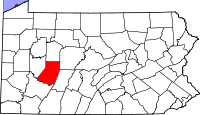
 Location in the U.S. state of Pennsylvania |
|
 Pennsylvania's location in the U.S. |
|
| Founded | November 3, 1806 |
| Seat | Indiana |
| Largest borough | Indiana |
| Area | |
| • Total | 834 sq mi (2,160 km2) |
| • Land | 827 sq mi (2,142 km2) |
| • Water | 7.3 sq mi (19 km2), 0.9% |
| Population (est.) | |
| • (2015) | 86,966 |
| • Density | 105/sq mi (41/km²) |
| Congressional district | 9th |
| Time zone | Eastern: UTC-5/-4 |
| Website | www |
Indiana County is a county located in the central west part of the U.S. state of Pennsylvania. As of the 2010 census, the population was 88,880. Its county seat is Indiana.
Prior to the American Revolutionary War, some settlers proposed this as part of a larger, separate colony to be known as Vandalia, but opposing interests and the war intervened. Afterward, claims to the territory by both the states of Virginia and Pennsylvania had to be reconciled. After this land was assigned to Pennsylvania by the federal government according to the Mason-Dixon Line, Indiana County was created on March 30, 1803, from parts of Westmoreland and Clearfield counties and was formally organized in 1806.
Indiana County (Indiana meaning "land of the Indians") derives its name from the so-called "Indiana Grant of 1768" that the Iroquois Six Nations were forced to make to "suffering traders" under the Fort Stanwix Treaty of 1768. The Iroquois had controlled much of the Ohio River valley as their hunting grounds since the 17th century, and Anglo-American colonists were moving into the area and wanted to develop it. Traders arranged to force the Iroquois to grant land under the treaty in relations to losses due to Pontiac's Rebellion.
Some of the grantees joined forces with the Ohio Company, forming a larger development company based on enlarging their grant of land. They proposed that the entire large area would become a new British colony, possibly to be called Pittsylvania or Vandalia. It was to be bordered on the north and west by the Ohio River, and made up of what are now parts of eastern Kentucky, northern West Virginia (then part of the Virginia Colony), and western Pennsylvania. Anglo-European colonists from Virginia and Pennsylvania had already started to move into the area, which was identified by these various names as Indiana and the other above names on some maps of the late 1700s.
...
Wikipedia
