Imabari, Ehime
|
Imabari 今治市 |
||
|---|---|---|
| City | ||

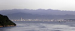
View of Seto Inner Sea and downtown Imabari
|
||
|
||
 Location of Imabari in Ehime Prefecture |
||
| Location in Japan | ||
| Coordinates: 34°4′N 133°0′E / 34.067°N 133.000°ECoordinates: 34°4′N 133°0′E / 34.067°N 133.000°E | ||
| Country | Japan | |
| Region | Shikoku | |
| Prefecture | Ehime Prefecture | |
| Government | ||
| • Mayor | Ryoji Kan (since February 2009) | |
| Area | ||
| • Total | 419.56 km2 (161.99 sq mi) | |
| Population (January 1, 2010) | ||
| • Total | 172,384 | |
| • Density | 410.87/km2 (1,064.1/sq mi) | |
| Symbols | ||
| • Tree | Camphor Laurel | |
| • Flower | Azalea | |
| Time zone | Japan Standard Time (UTC+9) | |
| City hall address | 1-4-1 Bekku-chō, Imabari-shi, Ehime-ken 794-8511 |
|
| Website | www |
|
Imabari (今治市 Imabari-shi?) is a city in Ehime Prefecture, Japan. It is the second largest city in Ehime Prefecture.
Following a recent merger, as of January 1, 2010, the city has an estimated population of 172,384 and population density of 410.87 persons per km². The total (merged) area is 419.56 km².
The area in which Imabari is situated had long been a strategic point for the control of the Seto Inland Sea. As a result, it was controlled by a variety of forces throughout the warring period, including a number of inland sea pirates. The city was officially founded on February 11, 1920.
On January 16, 2005, the towns of Hakata, Kamiura, Kikuma, Miyakubo, Namikata, Ōmishima, Ōnishi, Tamagawa, and Yoshiumi, and the villages of Asakura and Sekizen (all from Ochi District) were merged into Imabari. As a result, there are no more villages within Ehime Prefecture.
Imabari is home to a large number of shipbuilding and maritime servicing facilities along the northern and eastern coastlines of the city. Facilities include a small container port and maintenance and construction shipyards belonging to Imabari Shipbuilding, Japan's largest ship builder.
...
Wikipedia


