Ida, Louisiana
| Ida, Louisiana | |
| Village | |
|
Capt. Fletcher E. Adams 357th Fighter Group Museum
|
|
| Country | United States |
|---|---|
| State | Louisiana |
| Parish | Caddo |
| Elevation | 272 ft (82.9 m) |
| Coordinates | 33°00′09″N 93°53′35″W / 33.00250°N 93.89306°WCoordinates: 33°00′09″N 93°53′35″W / 33.00250°N 93.89306°W |
| Area | 1.4 sq mi (3.6 km2) |
| - land | 1.4 sq mi (3.6 km2) |
| - water | 0.0 sq mi (0 km2), 0% |
| Population | 221 (2010) |
| Density | 158.3/sq mi (61.1/km2) |
| Timezone | CST (UTC-6) |
| - summer (DST) | CDT (UTC-5) |
| Area code | 318 |
|
Location in Caddo Parish and the state of Louisiana.
|
|
|
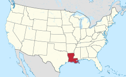
Location of Louisiana in the United States
|
|
Ida is a village in Caddo Parish, Louisiana, United States. The population was 221 at the 2010 census. It is part of the Shreveport–Bossier City Metropolitan Statistical Area. Ida and nearby Rodessa are the most northwesterly communities in Louisiana.
Ida is located in northernmost Caddo Parish at 33°0′9″N 93°53′35″W / 33.00250°N 93.89306°W (33.002606, -93.892931), just south of the Arkansas border. U.S. Route 71 runs through the village, leading north 34 miles (55 km) to Texarkana, Arkansas, and south 36 miles (58 km) to Shreveport. When completed, Interstate 49 will parallel US 71 between the two cities and run just west of Ida.
According to the United States Census Bureau, the village has a total area of 1.4 square miles (3.6 km2), all land.
As of the census of 2000, there were 258 people, 117 households, and 80 families residing in the village. The population density was 185.4 inhabitants per square mile (71.7/km²). There were 133 housing units at an average density of 95.6 per square mile (36.9/km²). The racial makeup of the village was 97.67% White, 1.55% African American, 0.39% Native American, and 0.39% from two or more races. Hispanic or Latino of any race were 0.39% of the population.
...
Wikipedia


