Rodessa, Louisiana
| Rodessa, Louisiana | |
| Village | |
| Country | United States |
|---|---|
| State | Louisiana |
| Parish | Caddo |
| Elevation | 230 ft (70.1 m) |
| Coordinates | 32°58′17″N 93°59′45″W / 32.97139°N 93.99583°WCoordinates: 32°58′17″N 93°59′45″W / 32.97139°N 93.99583°W |
| Area | 1.2 sq mi (3.1 km2) |
| - land | 1.2 sq mi (3.1 km2) |
| - water | 0.0 sq mi (0 km2), 0% |
| Population | 270 (2010) |
| Density | 219.9/sq mi (84.9/km2) |
| Mayor | Paul W. Lockard (elected 2012) |
| Timezone | CST (UTC-6) |
| - summer (DST) | CDT (UTC-5) |
| Area code | 318 |
|
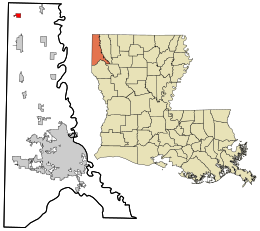
Location in Caddo Parish and the state of Louisiana.
|
|
|
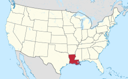
Location of Louisiana in the United States
|
|
Rodessa is a village in Caddo Parish, Louisiana, United States. The population was 270 at the 2010 census. It is part of the Shreveport–Bossier City Metropolitan Statistical Area.
Rodessa is located in northwestern Caddo Parish at 32°58′17″N 93°59′45″W / 32.97139°N 93.99583°W (32.971486, -93.995941). It is the incorporated place in Louisiana closest to the state's northwest corner. Louisiana Highway 1 passes through the village, leading south 7 miles (11 km) to Vivian and northwest 15 miles (24 km) to Atlanta, Texas (as Texas State Highway 77).
According to the United States Census Bureau, Rodessa has a total area of 1.2 square miles (3.2 km2), all land.
As of the census of 2000, there were 307 people, 119 households, and 81 families residing in the village. The population density was 367.7 inhabitants per square mile (142.8/km²). There were 131 housing units at an average density of 156.9 per square mile (60.9/km²). The racial makeup of the village was 70.36% White, 27.69% African American, 1.63% Native American, and 0.33% from two or more races. Hispanic or Latino of any race were 0.33% of the population.
...
Wikipedia


