Hyphasis
| Beas River | |
|
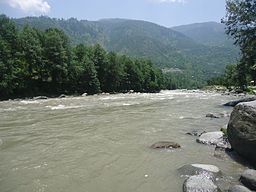
The Beas River in Himachal Pradesh
|
|
| Country | India |
|---|---|
| States | Himachal Pradesh, Punjab |
| Source | Beas Kund |
| - location | Himalayas, Himachal Pradesh |
| - coordinates | 32°21′59″N 77°05′08″E / 32.36639°N 77.08556°E |
| Mouth | Sutlej River |
| - coordinates | 31°09′16″N 74°58′31″E / 31.15444°N 74.97528°ECoordinates: 31°09′16″N 74°58′31″E / 31.15444°N 74.97528°E |
| Length | 470 km (292 mi) |
| Basin | 20.303 km2 (8 sq mi) |
| Discharge | for Mandi Plain |
| - average | 499.2 m3/s (17,629 cu ft/s) |
The Beas River also known as the Biás or Bias, (Sanskrit, Vipasa; Greek, Hyphasis), is a river in north India. The river rises in the Himalayas in central Himachal Pradesh, India, and flows for some 470 kilometres (290 mi) to the Sutlej River in the Indian state of Punjab.
Its total length is 470 kilometres (290 mi) and its drainage basin is 20,303 square kilometres (7,839 sq mi) large.
The river was also known as Arjikuja of the Vedas, or Vipasha to the ancient Indians, and the Hyphasis to the Ancient Greeks.
It is said that Beas is a misnomer for Vyasa (exchange of B with V and always truncation of the last vowel is common in North Indian languages) and is named after Veda Vyasa, the presiding patron of the river; he is said to have created it from its source lake, the Vyas Kund.
The Beas River marks the eastern-most border of Alexander the Great's conquests in 326 BC. It was one of the rivers which created problems in Alexander's invasion of India. His troops mutinied here in 326 BCE, refusing to go any further; they had been away from home for eight years. Alexander shut himself in his tent for three days, but when his men did not change their desires he gave in, raising twelve colossal altars to mark the limit and glory of his expedition.
According to the Kavyamimansa of Rajasekhara, the kingdom-territories of the Gurjara-Pratihara monarch Mahipala I extended as far as the upper course of the river Beas in the north-west.
In the 20th century, the river was developed under the Beas Project for irrigation and hydroelectric power generation purposes. The second-phase Pong Dam was completed in 1974 followed by the first-phase 140 kilometres (87 mi) upstream, Pandoh Dam in 1977. The Pong Dam served initially to primarily provide irrigation below Talwara but was soon developed as well for power generation; its power station has a 360 MW installed capacity. The Pandoh Dam diverts the river through a system of tunnels and channels to the 990 MW Dehar Power Station on the Sutlej River, connecting both rivers.
...
Wikipedia

