Hyder, Alaska
| Hyder, Alaska | |
|---|---|
| CDP | |

The border between Stewart, British Columbia and Hyder, as seen from the Canadian side.
|
|
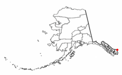
 Location of Hyder, Alaska. |
|
| Coordinates: 55°54′51″N 130°01′28″W / 55.91417°N 130.02444°WCoordinates: 55°54′51″N 130°01′28″W / 55.91417°N 130.02444°W | |
| Country | United States |
| State | Alaska |
| Census area | Prince of Wales-Hyder |
| Government | |
| • State senator | Bert Stedman (R) |
| • State rep. | Dan Ortiz (I) |
| Area | |
| • Total | 14.8 sq mi (38.4 km2) |
| • Land | 14.8 sq mi (38.4 km2) |
| • Water | 0.0 sq mi (0.0 km2) |
| Elevation | 118 ft (36 m) |
| Population (2010) | |
| • Total | 87 |
| • Density | 5.9/sq mi (2.3/km2) |
| Time zone | Official time: Alaska (AKST) Unofficial time: PST |
| • Summer (DST) | Official time: AKDT Unofficial time: PDT (UTC) |
| ZIP Code | 99923 |
| Area code(s) | 250, 236 |
| FIPS code | 02-34570 |
| GNIS feature ID | 1422711 |
Hyder is a census-designated place (CDP) in Prince of Wales-Hyder Census Area, Alaska, United States. The population was 87 at the 2010 census. Hyder has achieved notice as a point in Alaska accessible to automobile and motorbike travelers in Canada and the United States who want to say that they have been to Alaska. Hyder is also the easternmost town in Alaska.
Hyder is located at 55°56′29″N 130°3′16″W / 55.94139°N 130.05444°W (55.941442, -130.054504), at the head of the Portland Canal, a 130-mile (210 km) long fjord which forms a portion of the border between the U.S. and Canada at the southeastern edge of the Alaska Panhandle. It sits about 2 miles (3.2 km) from Stewart, British Columbia by road, and 75 miles (121 km) from Ketchikan by air.
According to the U.S. Census Bureau, the CDP has a total area of 14.8 square miles (38 km2), all land.
As of the census of 2000, there were 97 people, 47 households, and 25 families residing in the CDP. The population density was 6.5 people per square mile (2.5/km²). There were 72 housing units at an average density of 4.9 per square mile (1.9/km²). The racial makeup of the CDP was 93 White, and 4 from two or more races. There was 1 Hispanic or Latino of any race.
There were 47 households out of which 9 had children under the age of 18 living with them, 24 were married couples living together, 1 had a female householder with no husband present, and 21 were non-families. 19 of all households were made up of individuals and 3 had someone living alone who was 65 years of age or older. The average household size was 2.06 and the average family size was 2.81.
...
Wikipedia
