Huron County, Michigan
| Huron County, Michigan | |
|---|---|
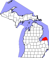
 Location in the U.S. state of Michigan |
|
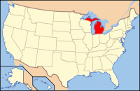
 Michigan's location in the U.S. |
|
| Founded | 1859 |
| Named for | Lake Huron |
| Seat | Bad Axe |
| Largest city | Bad Axe |
| Area | |
| • Total | 2,137 sq mi (5,535 km2) |
| • Land | 836 sq mi (2,165 km2) |
| • Water | 1,301 sq mi (3,370 km2), 61% |
| Population | |
| • (2010) | 33,118 |
| • Density | 40/sq mi (15/km²) |
| Congressional district | 10th |
| Time zone | Eastern: UTC-5/-4 |
| Website | www |
| Footnotes: U.S. Geological Survey Geographic Names Information System: Huron County, Michigan | |
Coordinates: 43°52′N 83°02′W / 43.867°N 83.033°W
Huron County is a county located in the U.S. state of Michigan. As of the 2010 census, the population was 33,118. The county seat is Bad Axe. Huron County is located at the northern tip of the Thumb, which in turn is a sub region of Mid Michigan. It is a peninsula, bordered by Saginaw Bay to the west and Lake Huron to the north and east, and has over 90 miles (140 km) of shoreline, from White Rock on Lake Huron to Sebewaing on the Saginaw Bay. Huron County's most important industry is agriculture, as with most of the other Thumb counties. Huron County enjoys seasonal tourism from large cities such as Detroit, Flint, and Saginaw. It is the home of Exelon Wind's Harvest 1 Wind Project.
Huron County was originally attached to Sanilac and Tuscola counties. It was created by Michigan Law on April 1, 1840 and was fully organized by an Act of Legislature on January 25, 1859. Sand Beach (now Harbor Beach) was then county seat, until 1865, when the court house burned with nearly all the records. It was moved to Port Austin and remained there until 1873, when the Board of Supervisors permanently made Bad Axe the County Seat.
...
Wikipedia
