Hughesdale, Victoria
|
Hughesdale Melbourne, Victoria |
|||||||||||||
|---|---|---|---|---|---|---|---|---|---|---|---|---|---|

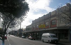
Poath Road Village shopping centre is the heart of suburban Hughesdale and retains a distinctively interwar character
|
|||||||||||||
| Coordinates | 37°53′38″S 145°05′06″E / 37.894°S 145.085°ECoordinates: 37°53′38″S 145°05′06″E / 37.894°S 145.085°E | ||||||||||||
| Population | 7,055 (2011 census) | ||||||||||||
| • Density | 3,500/km2 (9,100/sq mi) | ||||||||||||
| Postcode(s) | 3166 | ||||||||||||
| Area | 2 km2 (0.8 sq mi) | ||||||||||||
| Location | 14 km (9 mi) from Melbourne | ||||||||||||
| LGA(s) | City of Monash | ||||||||||||
| State electorate(s) | Oakleigh | ||||||||||||
| Federal Division(s) | |||||||||||||
|
|||||||||||||
Hughesdale is a suburb in Melbourne, Victoria, Australia, 14 km south-east of Melbourne's central business district. Its local government area is the City of Monash. At the 2011 Census, Hughesdale had a population of 7,055.
Just 2sq km in size, it is the smallest suburb in the City of Monash. Hughesdale is bordered by Poath Road to the west, Dandenong Road to the north, Warrigal Road to the east and North Road to the south.
It is named after James Vincent Hughes, former mayor of City of Oakleigh who lobbied heavily for a new station for the area in the mid-1920s.
Hughesdale began, not as a Melbourne suburb, but as a suburban area of Oakleigh along the railway line between it and Murrumbeena. In the 1880s, due to the presence of the railway the stretch of land attracted some professionals who established substantial homes on large estates. Many of its earliest homes are part of Oakleigh and Murrumbeena's early history. The original township was laid out around Poath Road with small lanes, some cobbled in bluestone.
James Vincent Hughes, mayor of City of Oakleigh from 1924 to 1925 lobbied heavily with the Poath Road Railway Station League for a new railway station for the area. In 1924 the League suggested the station be called "Hugheston", but in February 1925, shortly before the station opened, Victorian Railways decided its name would be "Hughesdale". A decade later there was a move to rename Poath Road "Hughesdale Road", but this was rejected by the then Caulfield City Council.
Following the opening of railway station on 28 February 1925 the suburb boomed with a commercial area rapidly springing up near the station along Poath Road and subdivision of sparse land between Murrumbeena and Oakleigh for residential development.
Hughesdale Post Office opened on 12 December 1927.
Rapid industrialisation and expansion of both Melbourne and Oakleigh in the 1940s saw Hughesdale become entrenched as a Melbourne suburb and commuter zone. Hughesdale inherited the modified grid plan of neighbouring suburbs and the original Victorian era estates were converted to greenfield land eventually making way for affordable working class housing developments.
...
Wikipedia

