Huberdeau, Quebec
| Huberdeau | |
|---|---|
| Municipality | |
 |
|
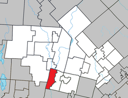
 Location within Les Laurentides RCM |
|
| Location in central Quebec | |
| Coordinates: 45°58′N 74°38′W / 45.967°N 74.633°WCoordinates: 45°58′N 74°38′W / 45.967°N 74.633°W | |
| Country |
|
| Province |
|
| Region | Laurentides |
| RCM | Les Laurentides |
| Constituted | June 8, 1926 |
| Government | |
| • Mayor | Évelyne Charbonneau |
| • Federal riding | Laurentides—Labelle |
| • Prov. riding | Labelle |
| Area | |
| • Total | 59.50 km2 (22.97 sq mi) |
| • Land | 56.73 km2 (21.90 sq mi) |
| Population (2011) | |
| • Total | 894 |
| • Density | 15.8/km2 (41/sq mi) |
| • Pop 2006-2011 |
|
| • Dwellings | 531 |
| Time zone | EST (UTC−5) |
| • Summer (DST) | EDT (UTC−4) |
| Postal code(s) | J0T 1G0 |
| Area code(s) | 819 |
| Highways |
|
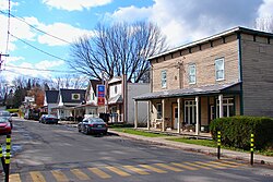
Huberdeau is a village and municipality in the Laurentides region of Quebec, Canada, part of the Les Laurentides Regional County Municipality. It is located along the western banks of the Rouge River.
Population trend:
Private dwellings occupied by usual residents: 409 (total dwellings: 531)
Mother tongue:
...
Wikipedia

