Les Laurentides Regional County Municipality
| Les Laurentides | |
|---|---|
| Regional county municipality | |
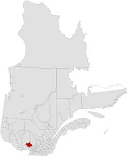
 Location in province of Quebec. |
|
| Coordinates: 46°07′N 74°36′W / 46.117°N 74.600°WCoordinates: 46°07′N 74°36′W / 46.117°N 74.600°W | |
| Country |
|
| Province |
|
| Region | Laurentides |
| Effective | January 1, 1983 |
| County seat | Saint-Faustin–Lac-Carré |
| Government | |
| • Type | Prefecture |
| • Prefect | Ronald Provost |
| Area | |
| • Total | 2,599.70 km2 (1,003.75 sq mi) |
| • Land | 2,478.67 km2 (957.02 sq mi) |
| Population (2011) | |
| • Total | 45,157 |
| • Density | 18.2/km2 (47/sq mi) |
| • Pop 2006-2011 |
|
| • Dwellings | 33,866 |
| Time zone | EST (UTC−5) |
| • Summer (DST) | EDT (UTC−4) |
| Area code(s) | 819 |
| Website | www |
Les Laurentides (The Laurentians) is a regional county municipality in the Laurentides region of Quebec, Canada. The seat is in Saint-Faustin–Lac-Carré. It is named after the Laurentian Mountains.
The population is 45,157 according to the Canada 2011 Census.
Highways and numbered routes that run through the municipality, including external routes that start or finish at the county border:
...
Wikipedia
