Hualālai
| Hualālai | |
|---|---|

View of Hualālai over 1800 lava flow
|
|
| Highest point | |
| Elevation | 8,271 ft (2,521 m) |
| Prominence | 3,071 ft (936 m) |
| Coordinates | 19°41′32″N 155°52′02″W / 19.69222°N 155.86722°WCoordinates: 19°41′32″N 155°52′02″W / 19.69222°N 155.86722°W |
| Naming | |
| Pronunciation | Hawaiian pronunciation: [huəˈlaːlei] |
| Geography | |
| Parent range | Hawaiian Islands |
| Topo map | USGS Hualālai |
| Geology | |
| Age of rock |
Oldest dated rock: 128,000 BP |
| Mountain type | Shield volcano |
| Volcanic arc/belt | Hawaiian-Emperor seamount chain |
| Last eruption | 1800 to 1801 |
| Climbing | |
| Easiest route | Multiple trails exist. |
Oldest dated rock: 128,000 BP
Estimated:
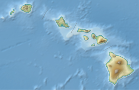
Hualālai (pronounced [huwəˈlaːlɐi] in Hawaiian) is an active volcano on the island of Hawaiʻi in the Hawaiian Islands. It is the westernmost, third-youngest and the third most active of the five shield volcanoes that form the island of Hawaiʻi, following Kīlauea and the much larger Mauna Loa. Its peak stands 8,271 feet (2,521 m) above sea level. Hualālai is estimated to have risen above sea level about 300,000 years ago. Despite maintaining a very low level of activity since its last eruption in 1801, Hualālai is still considered active, and is expected to erupt again some time within the next century. The relative unpreparedness of the residents in the area caused by the lull in activity would worsen the consequences of such an event.
The area near the volcano has been inhabited for centuries by Hawaiian natives, dating back to before recorded history. The coast west of Hualālai in particular had several royal complexes. The volcano is also important ecologically, is home to many rare species and several nature reserves near the summit, and is a popular hiking attraction. Today the coast near Hualālai is dotted by vacation resorts, some built on historic flows, and a National Historical Park.
Hualālai stands at 8,271 ft (2,521 m) with a prominence of 3,071 ft (936 m). It is the westernmost of the five major volcanoes which form the island of Hawaiʻi. Being in the post-shield stage of development, Hualālai is overall much rougher in shape and structure than the more youthful Mauna Loa and Kīlauea. Hualālai's structure is denoted by three rift zones: a well-developed one approximately 50° to the northwest, a moderately developed one to the southeast, and a poorly developed one trending northwards about 3 mi (5 km) east of the summit. There are over 100 cinder and spatter cones arranged along these rift zones. Hualālai has no summit caldera, although there is a collapse crater about 0.3 mi (0.48 km) across atop a small lava shield. Much of the southern slope (above the modern town of Kailua-Kona) consists of lava flows covered by a layer of volcanic ash from 10 to 100 cm (4 to 39 in) thick. In comparison with the other volcanoes of the island of Hawaiʻi, it is the third tallest, third oldest, third most active, and second smallest, making up just 7% of the island.
...
Wikipedia

