Houdan
| Houdan | ||
|---|---|---|

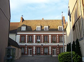
Town hall
|
||
|
||
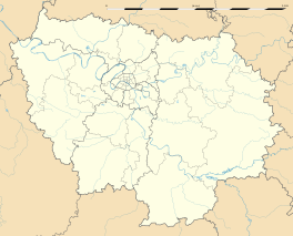
| Coordinates: 48°47′N 1°36′E / 48.79°N 1.60°ECoordinates: 48°47′N 1°36′E / 48.79°N 1.60°E | ||
| Country | France | |
| Region | Île-de-France | |
| Department | Yvelines | |
| Arrondissement | Mantes-la-Jolie | |
| Canton | Houdan | |
| Intercommunality | Pays houdanais | |
| Government | ||
| • Mayor (2001–2008) | Jean-Marie Tétart | |
| Area1 | 10.39 km2 (4.01 sq mi) | |
| Population (2006)2 | 3,141 | |
| • Density | 300/km2 (780/sq mi) | |
| Time zone | CET (UTC+1) | |
| • Summer (DST) | CEST (UTC+2) | |
| INSEE/Postal code | 78310 /78550 | |
| Elevation | 87–129 m (285–423 ft) (avg. 104 m or 341 ft) |
|
|
1 French Land Register data, which excludes lakes, ponds, glaciers > 1 km² (0.386 sq mi or 247 acres) and river estuaries. 2Population without double counting: residents of multiple communes (e.g., students and military personnel) only counted once. |
||
1 French Land Register data, which excludes lakes, ponds, glaciers > 1 km² (0.386 sq mi or 247 acres) and river estuaries.
Houdan is a commune in the Yvelines department in the Île-de-France region in north-central France.
Houdan is 63 kilometres (39 mi) west of Paris in the Yvelines département. It is linked by SNCF Alençon and Paris (Gare Montparnasse).
The name has evolved from the Saxon "Hoding," meaning "settlement on the hill". Houdan is thought to have been inhabited since the 5th century. By the 12th century, two churches and a château were present.
During the Hundred Years' War, the town changed hands and was pillaged frequently. The town was destroyed; only the 12th century keep survives from that period. After the war, the town was ruled by the English until 1475.
Houdan is mentioned in the Prophecies of Nostradamus.
Houdan was a staging post on the road from Paris to Brittany, and many old inns are still standing.
Houdan was also an important poultry market for Paris and a breed is named after the town. The breed is ornamental, but is also used for its meat and white eggs.
Houdan is twinned with:
...
Wikipedia


