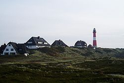
Hornum
| Hörnum | ||
|---|---|---|
 |
||
|
||
| Coordinates: 54°45′38″N 8°17′29″E / 54.76056°N 8.29139°ECoordinates: 54°45′38″N 8°17′29″E / 54.76056°N 8.29139°E | ||
| Country | Germany | |
| State | Schleswig-Holstein | |
| District | Nordfriesland | |
| Municipal assoc. | Landschaft Sylt | |
| Government | ||
| • Mayor | Rolf Speth | |
| Area | ||
| • Total | 6 km2 (2 sq mi) | |
| Elevation | 4 m (13 ft) | |
| Population (2015-12-31) | ||
| • Total | 902 | |
| • Density | 150/km2 (390/sq mi) | |
| Time zone | CET/CEST (UTC+1/+2) | |
| Postal codes | 25997 | |
| Dialling codes | 0465122 | |
| Vehicle registration | NF | |
| Website | Municipal website | |
Hörnum (Sölring Frisian: Hörnem, Danish: Hørnum) is a municipality in the district of Nordfriesland, in Schleswig-Holstein, Germany. It is located on the southern headland of the island of Sylt. The municipality is part of the Amt Landschaft Sylt. The economy is dominated by tourism.
Hörnum's name is derived from Hörn ("corner" or "edge").
Hörnum is located on the southern tip of Sylt. Most of the municipal territory is covered by nature reserves (mostly dunes and heath). The Hörnum Odde is the southernmost point of the island and subject to constant erosion by wind and sea.
Although fishermen had reportedly settled in the area prior to 1500 AD, the place is first recorded in 1649 as Hornum. The name "Hörnum" was already known to the chronicler Muchel-Madis (* 11 November 1572 in Morsum; † 21 January 1651), who in his chronicles reports a shipwrecking "1571... off Hörnum". In 1648, the area was named "Hörnum" on a map by cartographer Johannes Mejer (1606–1674). The southern tip of the island remained unsettled though for a long time, because not only storm surges but also shifting dunes, which would repeatedly bury houses, made a colonisation difficult. Only in the late 18th century, this effect could be stopped by planting vegetation on the dunes. "On Hörnum", as the entire southern peninsula of Sylt used to be called, there were at first only a few fishermen. A single house stood in the dunes at Budersand from 1765 to 1785. It served for storing flotsam, but was soon torn down by people from Amrum and Rantum. In 1787, only the foundations were left.
There were no buildings in the area until the construction of a Hamburg America Line (HAPAG) pier. Long since, Hörnum had had a natural harbour east of Budersand, which remained largely unnoticed though. Only after a wooden wharf had been constructed, a regular ship line to Hamburg via Cuxhaven took up operations on 29 June 1901. Moreover, a seaside resort line Hörnum-Heligoland-Hamburg became active.
...
Wikipedia


