Hodge, Louisiana
| Village of Hodge | |
| Village | |
|
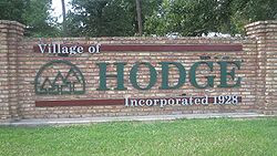
Hodge welcome sign
|
|
| Country | United States |
|---|---|
| State | Louisiana |
| Parish | Jackson |
| Elevation | 190 ft (57.9 m) |
| Coordinates | 32°16′19″N 92°43′36″W / 32.27194°N 92.72667°WCoordinates: 32°16′19″N 92°43′36″W / 32.27194°N 92.72667°W |
| Area | 1.4 sq mi (3.6 km2) |
| - land | 1.0 sq mi (3 km2) |
| - water | 0.4 sq mi (1 km2), 28.57% |
| Population | 492 (2000) |
| Density | 513.6/sq mi (198.3/km2) |
| Timezone | CST (UTC-6) |
| - summer (DST) | CDT (UTC-5) |
| Area code | 318 |
|
Location of Louisiana in the United States
|
|
Hodge is a village in Jackson Parish, Louisiana, United States. The population was 492 at the 2000 census. It is part of the Ruston Micropolitan Statistical Area.
Hodge is located at 32°16′19″N 92°43′36″W / 32.27194°N 92.72667°W (32.272082, -92.726557). According to the United States Census Bureau, the village has a total area of 1.4 square miles (3.6 km2). 1.0 square mile (2.6 km2) of it is land and 0.4 square miles (1.0 km2) of it (29.93%) is water.
It is on U.S. Highway 167, about two miles north of Jonesboro, the parish seat, and immediately adjacent to two other small villages: North Hodge and East Hodge. SR 147 intersects Highway 167 immediately north of Hodge.
As of the census of 2000, there were 492 people, 238 households, and 135 families residing in the village. The population density was 513.6 inhabitants per square mile (197.9/km²). There were 273 housing units at an average density of 285.0 per square mile (109.8/km²). The racial makeup of the village was 76.83% White, 22.15% African American, 0.20% Asian, 0.41% from other races, and 0.41% from two or more races.
...
Wikipedia


