Hochelaga, Quebec
| Hochelaga-Maisonneuve | |
|---|---|
| Neighbourhood | |

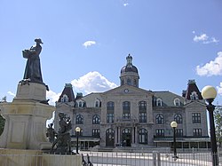
Marché Maisonneuve, in Hochelaga-Maisonneuve
|
|
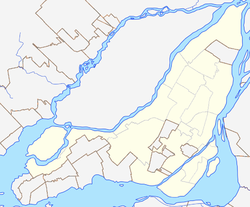
| Location of Hochelaga-Maisonneuve in Montreal | |
| Coordinates: 45°34′31″N 73°32′00″W / 45.57525°N 73.53325°WCoordinates: 45°34′31″N 73°32′00″W / 45.57525°N 73.53325°W | |
| Country | Canada |
| Province | Quebec |
| City | Montreal |
| Borough | Mercier–Hochelaga-Maisonneuve |
Hochelaga-Maisonneuve (French pronunciation: [ɔʃlaɡa mɛzɔ̃nœv]) is a district of Montreal, Quebec, situated on the eastern half of the island, generally to the south and southwest of the city's Olympic Stadium. A part of the borough of Mercier–Hochelaga-Maisonneuve, its borders are roughly Moreau Street to the west, Rachel Street to the north, Viau Street to the east, and the Saint Lawrence River to the south. Its population is a mix of working-class Québécois, students, and recent immigrants.
Named after the First Nations village of Hochelaga, encountered in 1535–36 by the explorer Jacques Cartier, the neighbourhood was at one time believed to be the location of the prehistoric village. Historians and anthropologists have not reached agreement on the location of Hochelaga, a village of the St. Lawrence Iroquoians, who spoke a Laurentian language and were distinct from the Iroquois nations of the Haudenosaunee.
Olympic Park, containing the Stadium, Olympic Tower, Saputo Stadium, Biodome, Olympic Pool, Maurice Richard Arena, and Parc Maisonneuve (located just across the border in the Rosemont La Petite Patrie borough), offer recreation for locals and tourists.
...
Wikipedia

