Hisar Airport
| Hisar Airport | |||||||||||
|---|---|---|---|---|---|---|---|---|---|---|---|
| Summary | |||||||||||
| Airport type | Public | ||||||||||
| Owner | Civil Aviation Department, Haryana | ||||||||||
| Operator | Haryana Institute of Civil Aviation | ||||||||||
| Location | Hisar | ||||||||||
| Elevation AMSL | 700 ft / 213 m | ||||||||||
| Coordinates | 29°10′45″N 075°45′19″E / 29.17917°N 75.75528°E | ||||||||||
| Map | |||||||||||
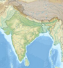
| Location of airport in India | |||||||||||
| Runways | |||||||||||
|
|||||||||||
Hisar Airport (IATA: HSS, ICAO: VIHR), also Hisar Aviation Club or Hisar Flying Club, is a current-public and proposed-army airport serving Hisar, Haryana, India. It is located 5 kilometres north-east from the city on National Highway 10.
In Hisar city itself, the airport is about 1 km from the Guru Jambheshwar University of Science and Technology; 2 km from the Blue Bird Lake; 4 km from the bus station along the National Highway 10, 5 km from the town center and main market area around Firoz Shah Palace Complex, 6 km from the Hisar Junction railway station, 7km from Mahabir Stadium, 11 km from Hisar Military Station, 11 km from Amardeep colony and 27 km from Kanwari.
In 1965, Hisar airfield, spread over 194 acres (79 ha), was built for the Hisar Aviation Club. In 1999, Hisar Aviation Club was merged with Haryana Institute of Civil Aviation (HICA). The airport is managed by HICA, which provides flight training using light aircraft.
In 2002, the Delhi Flying Club (DFC) shifted all its flying activities and aircraft to Hisar from Safdarjung Airport in Delhi.
In 2011, the Government of Haryana invited Request for Qualification (RFQ) from commercial parties for the setting up of Integrated General Aviation hubs as public–private partnerships; with Hisar to be one of the airports to have a hub. Expansion plans entail aircraft maintenance and Fixed Based Operator facilities.
...
Wikipedia

