Hippos
| סוסיתא | |

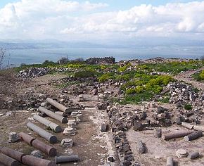
Ruins of Hippos' Byzantine cathedral, looking west. A Kalybe, a shrine of the Roman imperial cult, stands in the background against the Sea of Galilee.
|
|
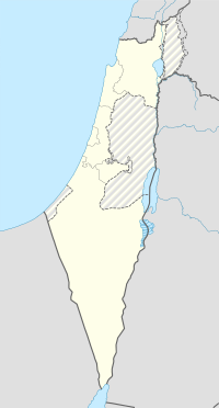
| Location | Northern District, Israel |
|---|---|
| Region | Golan Heights |
| Coordinates | 32°46′44″N 35°39′34″E / 32.778889°N 35.659444°E |
| Type | Settlement |
| History | |
| Abandoned | After 749 |
| Periods | Hellenistic to Umayyad |
| Site notes | |
| Archaeologists | Arthur Segal, Michael Eisenberg |
Hippos (Ancient Greek: Ἵππος, "horse") is an archaeological site in Israel, located on a hill overlooking the Sea of Galilee. Between the 3rd century BC and the 7th century AD, Hippos was the site of a Greco-Roman city, which then declined under Muslim rule and was abandoned after an earthquake in 749. Besides the fortified city itself, Hippos controlled two port facilities on the lake and an area of the surrounding countryside. Hippos was part of the Decapolis, or Ten Cities, a region in Roman Jordan, Syria and Israel that were culturally tied more closely to Greece and Rome than to the Semitic ethnoi around.
Established as Antioch of Hippos (Ἀντιόχεια τοῦ Ἵππου) by Seleucid settlers, the city is named after the Greek language word for horse, Hippos, and a common name of Seleucid monarchs, . In the 3rd-century Mosaic of Rehob, the site is known by its Aramaic name, Sussita (Hebrew: סוסיתא), a word meaning "horse" in the feminine gender, while the Arabic name, Qal'at al-Hisn, has been used by the country's Arab inhabitants, meaning, "Fortress of the Horse/Stallion". Other names include the alternate spelling Hippus and the Latinized version of the Greek name: Hippum. The precise reason why the city received this name is unknown.
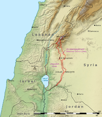
Hippos was built on a flat-topped foothill 2 kilometres (1.2 mi) east of and 350 metres (1,150 ft) above the Sea of Galilee, 144 metres (472 ft) above sea level, near modern Kibbutz Ein Gev. The site is just on the Israeli side of the 1949 UN-demarcated ceasefire line between Syria and Israel.
...
Wikipedia


