Hills and Dales, Ohio
| Hills and Dales, Ohio | |
|---|---|
| Village | |

Entering the village
|
|
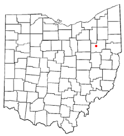
 Location of Hills and Dales, Ohio |
|
 Detailed map of Hills and Dales |
|
| Coordinates: 40°49′41″N 81°26′41″W / 40.82806°N 81.44472°WCoordinates: 40°49′41″N 81°26′41″W / 40.82806°N 81.44472°W | |
| Country | United States |
| State | Ohio |
| County | Stark |
| Township | Jackson |
| Area | |
| • Total | 0.32 sq mi (0.83 km2) |
| • Land | 0.32 sq mi (0.83 km2) |
| • Water | 0 sq mi (0 km2) |
| Elevation | 1,119 ft (341 m) |
| Population (2010) | |
| • Total | 221 |
| • Estimate (2012) | 221 |
| • Density | 690.6/sq mi (266.6/km2) |
| Time zone | Eastern (EST) (UTC-5) |
| • Summer (DST) | EDT (UTC-4) |
| ZIP code | 44708 |
| Area code(s) | 330 |
| FIPS code | 39-35532 |
| GNIS feature ID | 1064839 |
Hills and Dales is a village in Stark County, Ohio, United States. It is an affluent suburban enclave near Canton. Hills and Dales is part of the Canton–Massillon Metropolitan Statistical Area. The population was 221 at the 2010 census.
The name Hills and Dales was coined by property developers for the terrain of the town site.
Hills and Dales is located at 40°49′41″N 81°26′41″W / 40.82806°N 81.44472°W (40.828190, -81.444769).
According to the United States Census Bureau, the village has a total area of 0.32 square miles (0.83 km2), all land.
As of the census of 2010, there were 221 people, 97 households, and 67 families residing in the village. The population density was 690.6 inhabitants per square mile (266.6/km2). There were 113 housing units at an average density of 353.1 per square mile (136.3/km2). The racial makeup of the village was 92.8% White, 6.3% Asian, and 0.9% from two or more races. Hispanic or Latino of any race were 2.7% of the population.
...
Wikipedia
