Hewanorra International Airport
| Hewanorra International Airport | |||||||||||
|---|---|---|---|---|---|---|---|---|---|---|---|
 |
|||||||||||
| Summary | |||||||||||
| Airport type | Public | ||||||||||
| Operator | Saint Lucia Air and Seaports Authority | ||||||||||
| Location | Vieux Fort, Saint Lucia | ||||||||||
| Elevation AMSL | 14 ft / 4 m | ||||||||||
| Coordinates | 13°44′00″N 060°57′09″W / 13.73333°N 60.95250°WCoordinates: 13°44′00″N 060°57′09″W / 13.73333°N 60.95250°W | ||||||||||
| Website | http://www.uvfairport.com/ | ||||||||||
| Map | |||||||||||
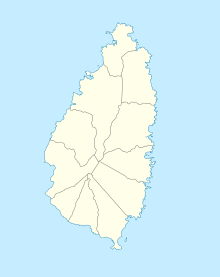
| Location in Saint Lucia | |||||||||||
| Runways | |||||||||||
|
|||||||||||
| Helipads | |||||||||||
|
|||||||||||
| Statistics (2016) | |||||||||||
|
|||||||||||
|
Source: DAFIF 2012 SLASPA Statistics
|
|||||||||||
| Passengers | 644,837 |
|---|---|
| Passenger change 15–16 |
|
| Aircraft movements | 16,157 |
| Movements change 15–16 |
|
Hewanorra International Airport (IATA: UVF, ICAO: TLPL), located near Vieux Fort Quarter, Saint Lucia, in the Caribbean, is the larger of Saint Lucia's two airports and is managed by the Saint Lucia Air and Seaports Authority (SLASPA). It is on the southern cape of the island, about 53.4 km (33.2 mi) from the capital city, Castries.
The airport is a Fire Category 9 facility that handles 500,000 passengers a year and can accommodate Boeing 747, Airbus A330, Airbus A340, Boeing 777, and other long-range intercontinental aircraft. Aircraft maintenance is carried out by Caribbean Dispatch Services. The country's smaller airport, George F. L. Charles Airport, is located in Castries and handles inter-Caribbean passenger flights, which are operated with turboprop and prop aircraft.
Hewanorra International Airport was originally named Beane Army Airfield and was used as a military airfield by the United States Army Air Forces' Sixth Air Force during World War II. Beane Field was activated in early 1941 with a mission to defend Saint Lucia against an enemy attack.
The former base was then refurbished and converted into a commercial airport. There is a disused northeast/southwest runway north of the main east–west runway that was part of the military airfield. It is in poor condition, along with a few dispersals.
The name of the airport is an Amerindian word meaning "[land of the] iguana", referring to what the Island Caribs called Saint Lucia.
...
Wikipedia

