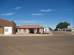
Hettinger, North Dakota
| Hettinger, North Dakota | |
|---|---|
| City | |

Hettinger
|
|
 Location of Hettinger, North Dakota |
|
| Coordinates: 46°0′3″N 102°38′0″W / 46.00083°N 102.63333°WCoordinates: 46°0′3″N 102°38′0″W / 46.00083°N 102.63333°W | |
| Country | United States |
| State | North Dakota |
| County | Adams |
| Founded | 1907 |
| Incorporated | 1908 |
| Area | |
| • Total | 0.86 sq mi (2.23 km2) |
| • Land | 0.85 sq mi (2.20 km2) |
| • Water | 0.01 sq mi (0.03 km2) |
| Elevation | 2,697 ft (822 m) |
| Population (2010) | |
| • Total | 1,226 |
| • Estimate (2015) | 1,257 |
| • Density | 1,400/sq mi (550/km2) |
| Time zone | Mountain (MST) (UTC-7) |
| • Summer (DST) | MDT (UTC-6) |
| ZIP code | 58639 |
| Area code(s) | 701 |
| FIPS code | 38-37700 |
| GNIS feature ID | 1029423 |
| Highways | US 12, ND 8 |
| Website | hettingernd.com |
Hettinger (/ˈhɛtɪŋɡər/ HET-ing-gər) is a city in, and the county seat of, Adams County, North Dakota, United States. The population was 1,226 at the 2010 census.
North Dakota State University operates a livestock research station near Hettinger, which often partners with South Dakota State University's for sheep research.
Hettinger was founded in 1907 along the Milwaukee Road's transcontinental rail line known as the Pacific Extension. The city and its surrounding township were named by popular demand in recognition of Hettinger County, from which Adams County was created in 1907.
According to the United States Census Bureau, the city has a total area of 0.86 square miles (2.23 km2), of which 0.85 square miles (2.20 km2) is land and 0.01 square miles (0.03 km2) is water.
According to the Köppen Climate Classification system, Hettinger has a semi-arid climate, abbreviated "BSk" on climate maps.
...
Wikipedia
